In the week leading up to today's adventure I had actually settled on somewhere else to go, but wasn't quite in the right headspace, so with some things on my mind I wanted a different sort of journey.
Lake Glenmaggie lookout viewing area
A longer drive with some freeway driving and to see some different landscapes.
So I chose Lake Glenmaggie.
Or to be more specific Lake Glenmaggie Weir Reserve.
It was a little over 200 kilometres and a bit more than 2 hours 30 minutes, give or take for the roadworks and slow traffic and all of that.
The journey started by getting away from the Mornington Peninsula, through Tooradin and Google Maps trying to route me to the M1 Princes Highway as quickly as possible.
But for whatever reason it routed me away from the Pakenham interchange and instead I enjoyed a drive through Koo Wee Rup, Bayles and along Koo Wee Rup-Longwarry Road. For what is an 80 speed limit road it comes to quite a sharp cross intersection with Chambers and Bridge Roads in Modella. I think it feels sharper because of the bridge and the armco barriers that are on both sides of the road around there.
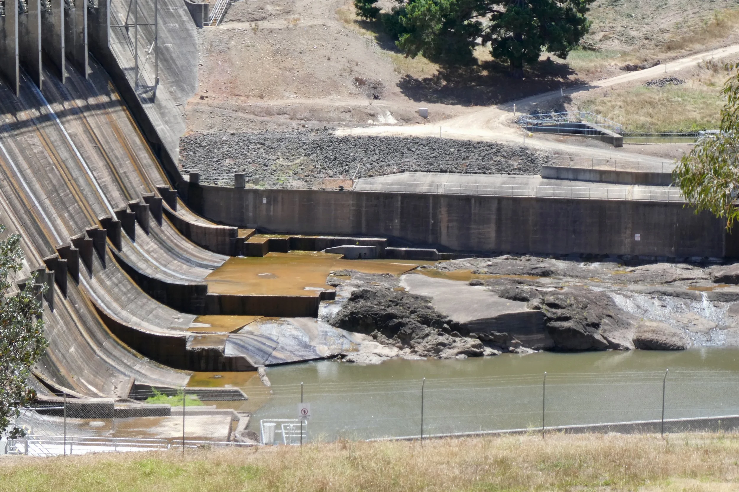
Lake Glenmaggie weir - Black and White Instax photo
Continuing through Longwarry and then onto the Princes Highway, then swinging onto the Princes Highway and needing to go all the way up to 110 kilometres.
It is kind of interesting that the Princes Highway passes through some towns where the speed limit drops back down to 80 before climbing back up, giving you a brief look as you come to stop at traffic lights in those towns.
Trafalgar I noticed has a Holden museum, something I didn't stop for today, but will probably return and visit at some point in the future.
I have driven the Princes Highway before, on my road trip to Canberra a couple of years ago. But today I took in the journey in a different way, with a different destination in mind.
As the Princes Freeway (now unshackled from its highway status) wound its way through Moe I took the John Field Drive exit, an exit that seemed to come up very quickly. Names like this are kinda intriguing and I went down a little rabbit hole of research to work out who John Field was.
Brigadier John Field served in the Australian Army in World War II, there's plenty more on his Wikipedia page, which doesn't mention John Field Drive. For that / to get context for who he was I had to take a little dive through different search terms until I found Virtual Yallourn and this newspaper scan - 'The Field of Power', where it mentions Brigadier John Field in relation to Newborough and Moe. Although this was three pages into the search results.
He was part of the State Electricity Commission and worked for them for more than a decade.
John Field Drive was obviously planned as a drive as it's a very wide boulevard with large green areas on both sides of the road before you get to the house boundary on one side and the sports fields on the other side.
The power stations in Yallourn seem obvious when you look at them on Google Earth, and I knew of Hazelwood (or where it had been), and Loy Yang, but sort of only vaguely knew where Yallourn power station was - or Yallourn W Power Station - to give it its full name was located.
So it was with some surprise and amusement that I realised that John Field Drive took me straight past it.
And it's magnificent in a way that only a big piece of 20th century engineering can be. Even the road layout around it has this very 1960s sort of design to it, from the over/under passes that go around it, and the use of grass and green space around the building, there's something very...beautiful might be pushing it, but designed in a certain way.
There's also something kind of amusing about where it's placed. If anyone has ever played SimCity 3000 before, and you kinda plan out your city and try to put the power stations away from everything else, but then you find your city running out of power so you just think 'ah...I'll just drop a power station on this awkward bit of land here, and run the roads around it, it'll do', and that's how I thought as I drove around Yallourn W.
Driving past the Old Brown Coal Mine Museum in Yallourn North I made a mental note to also revisit that. Again, not on my to do list for today.
The C103 - Brown Coal Mine Road leads you on some nice sweeping roads to Tyers. Which was interesting because there's some new development going on there.
Large country-style blocks, but still very new development. Tyers has a decently sized primary school, but not much in the way of other shops, there's the petrol station and the post office and that's it. Although Traralgon is only a 15 minute drive away.
Driving through Cowwarr was odd, because the road and gutters and everything along the C105 - Traralgon-Maffra Road seemed to have been re-surfaced and redone. But it seems to have been done in 2016 by the Andrews Government.
I had neglected to fill up with diesel earlier today as I hadn't intended really to go out like I had, so at this point I had a quarter of a tank - still well over 200 km to empty, which is what I kept telling myself, that I'd fill up once I was back closer to the freeway.
But then as I approached Heyfield and had driven the fairly lacking in people and vehicles drive from Cowwarr decided that while a quarter or even an eighth of a tank would be fine and safe to get me back to a larger town...I filled up in Heyfield at the Timberline General Store, a combination general store, petrol station and everything there.
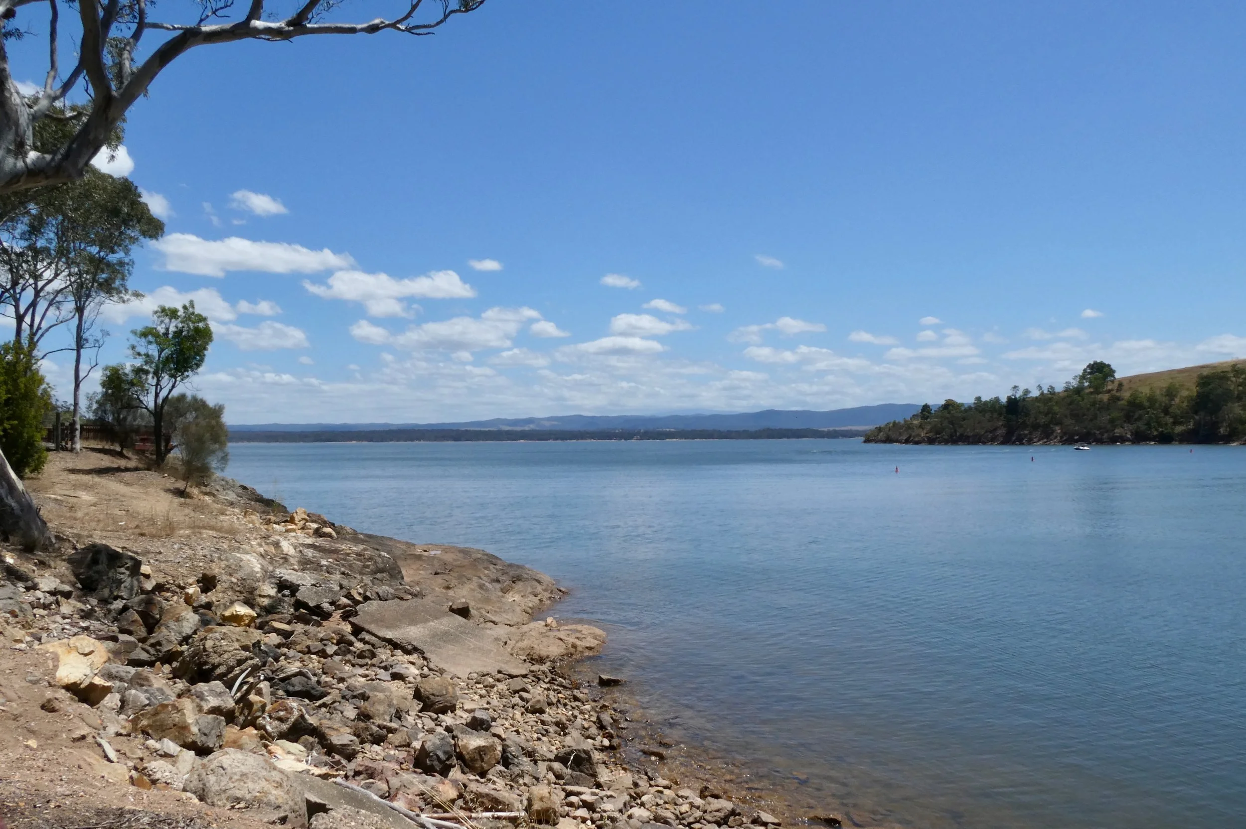
Lake Glenmaggie parking area near weir
In Heyfield to Lake Glenmaggie it's just down Weir Road, and along with a slight dogleg to stay on Weir Road as it crosses Tinambe-Glenmaggie Road, and then you can drive into Lake Glenmaggie Weir Reserve.
Be aware that there's all these signs saying 'road spikes' which does suggest that this location is a bit more serious than other reserves.
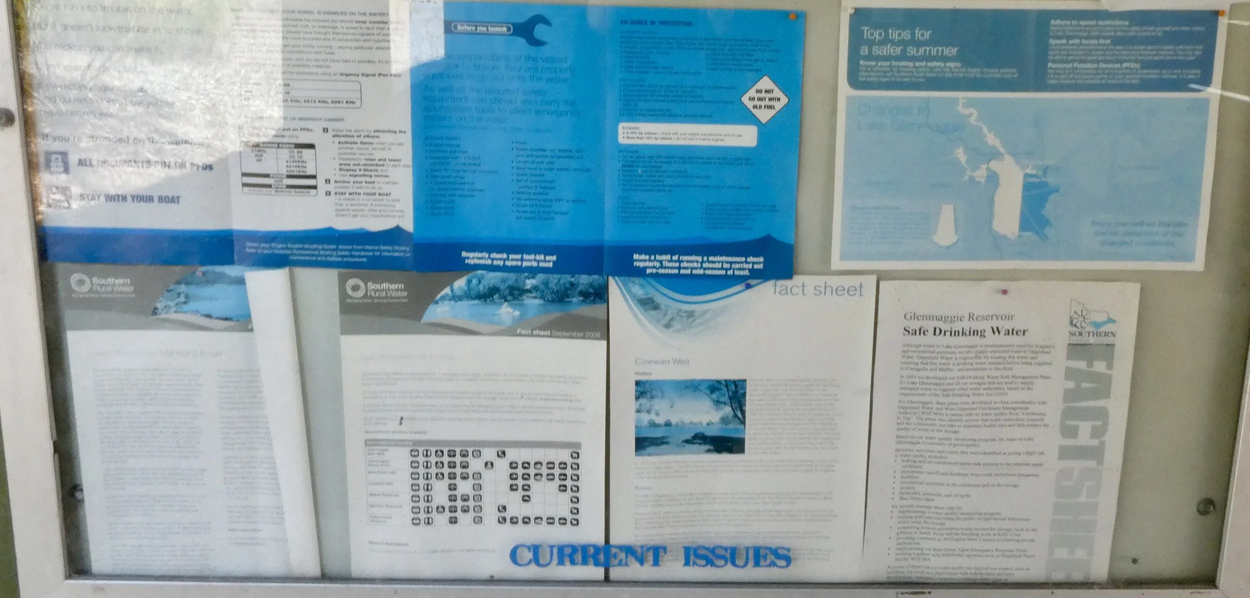
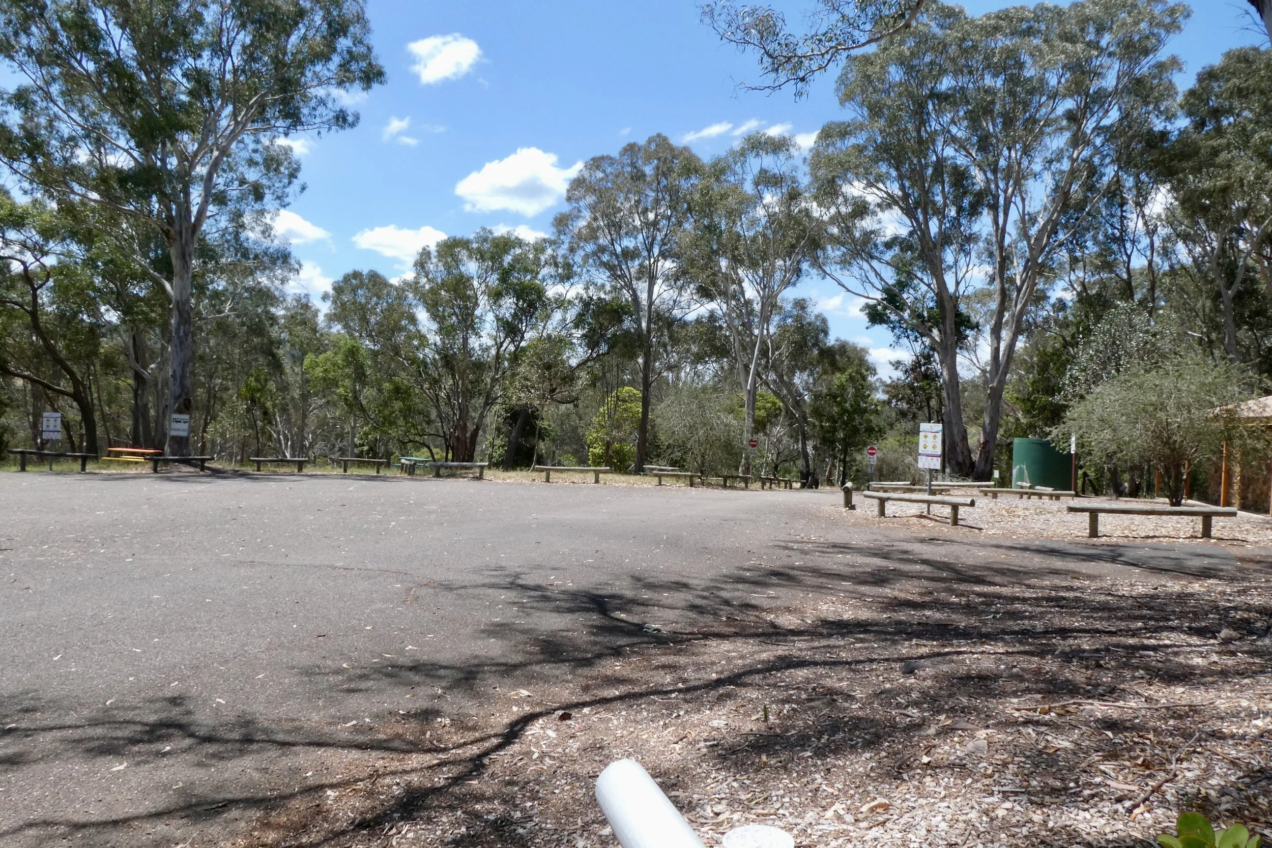
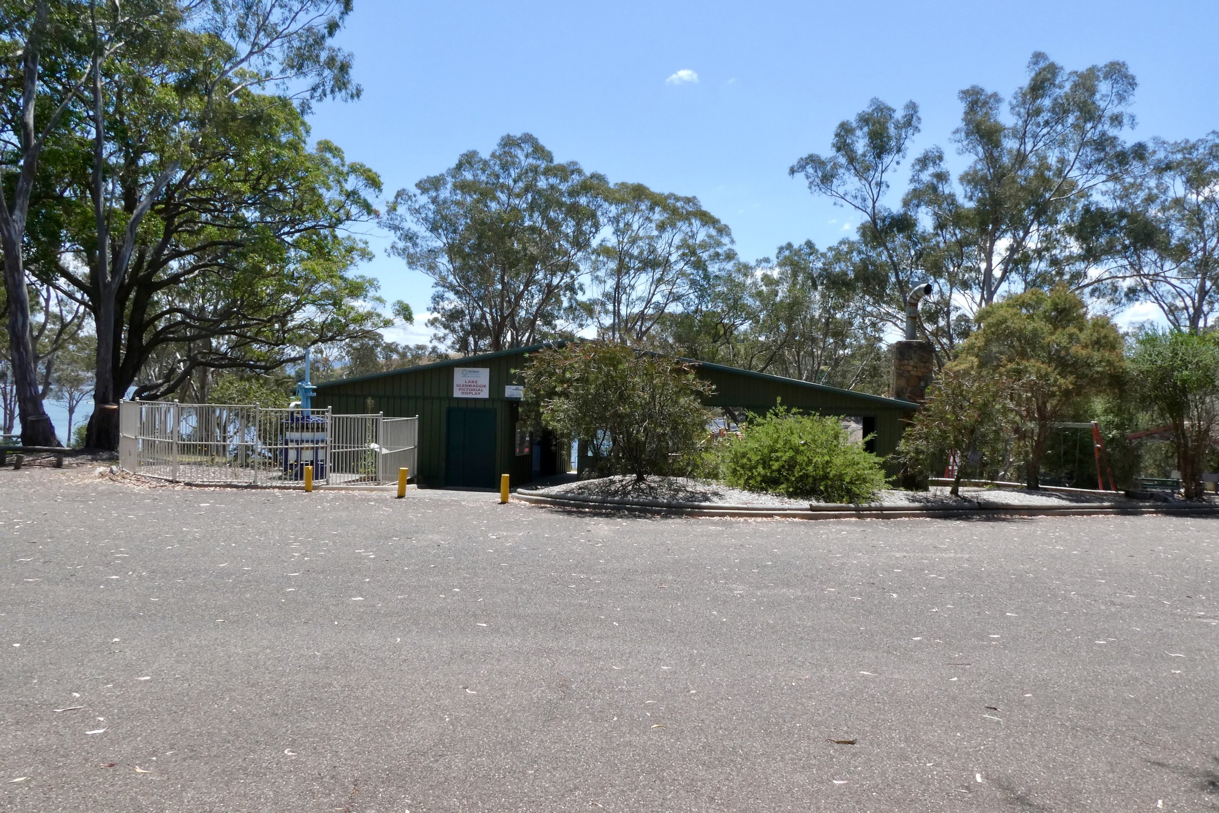
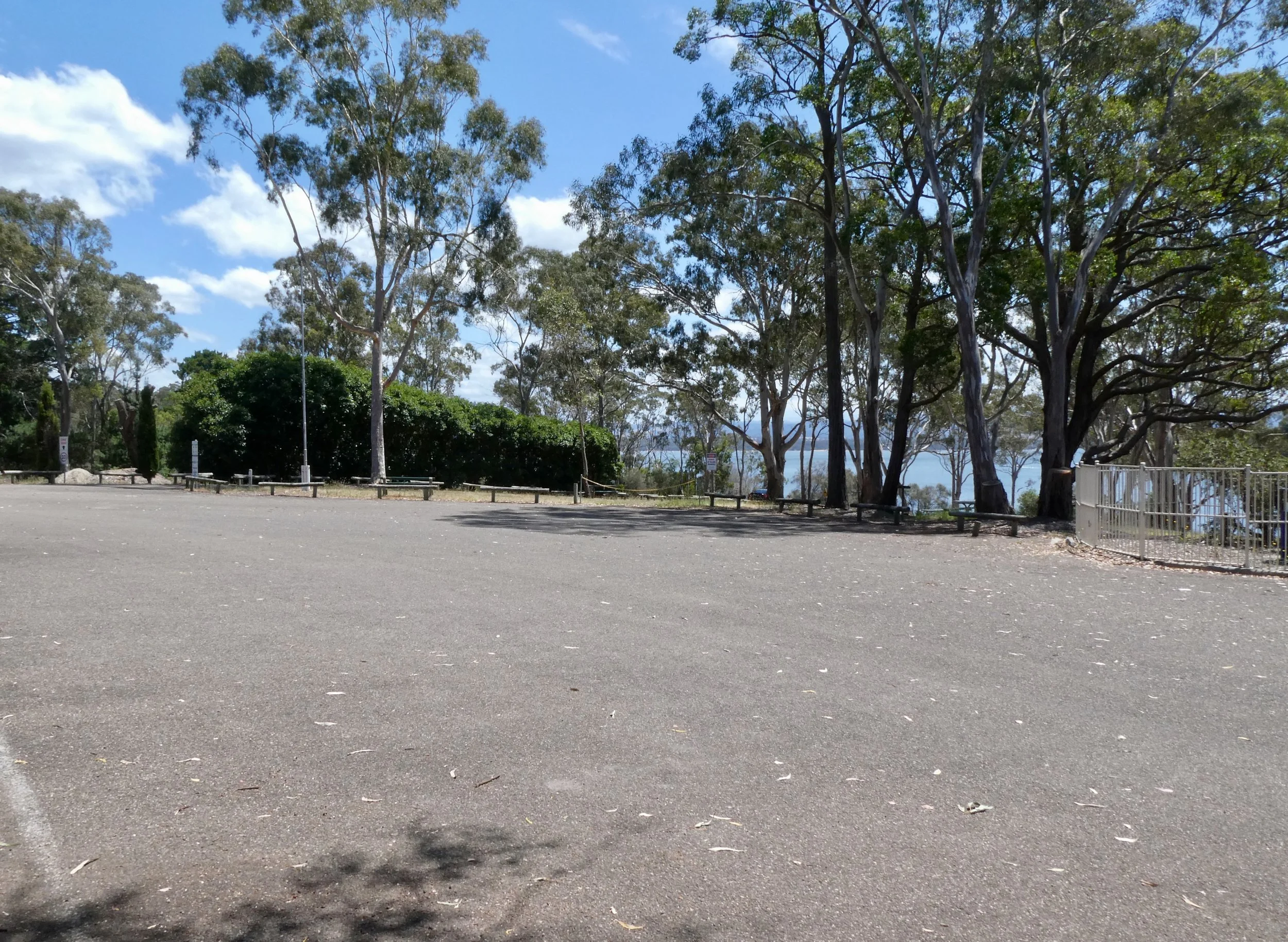
Driving in there's a car park, an information hut, toilets, some picnic tables and a small circuit where you can park closer to the weir itself.
I stopped, had a brief look around, drove around the circuit so I could look at the weir close up. You can't unfortunately walk along the weir, and there are a lot of signs warning you against this, along with razor wire, fencing and a lot of serious looking stuff to stop you even thinking about it.


I appeared to be the only one at the reserve, aside from the people working in the Southern Rural Water building.
Lake Glenmaggie with boat (far left)
There was one other car in the car park, but I didn't see anyone in my wanderings around I did.
There was one boat out on the lake itself.
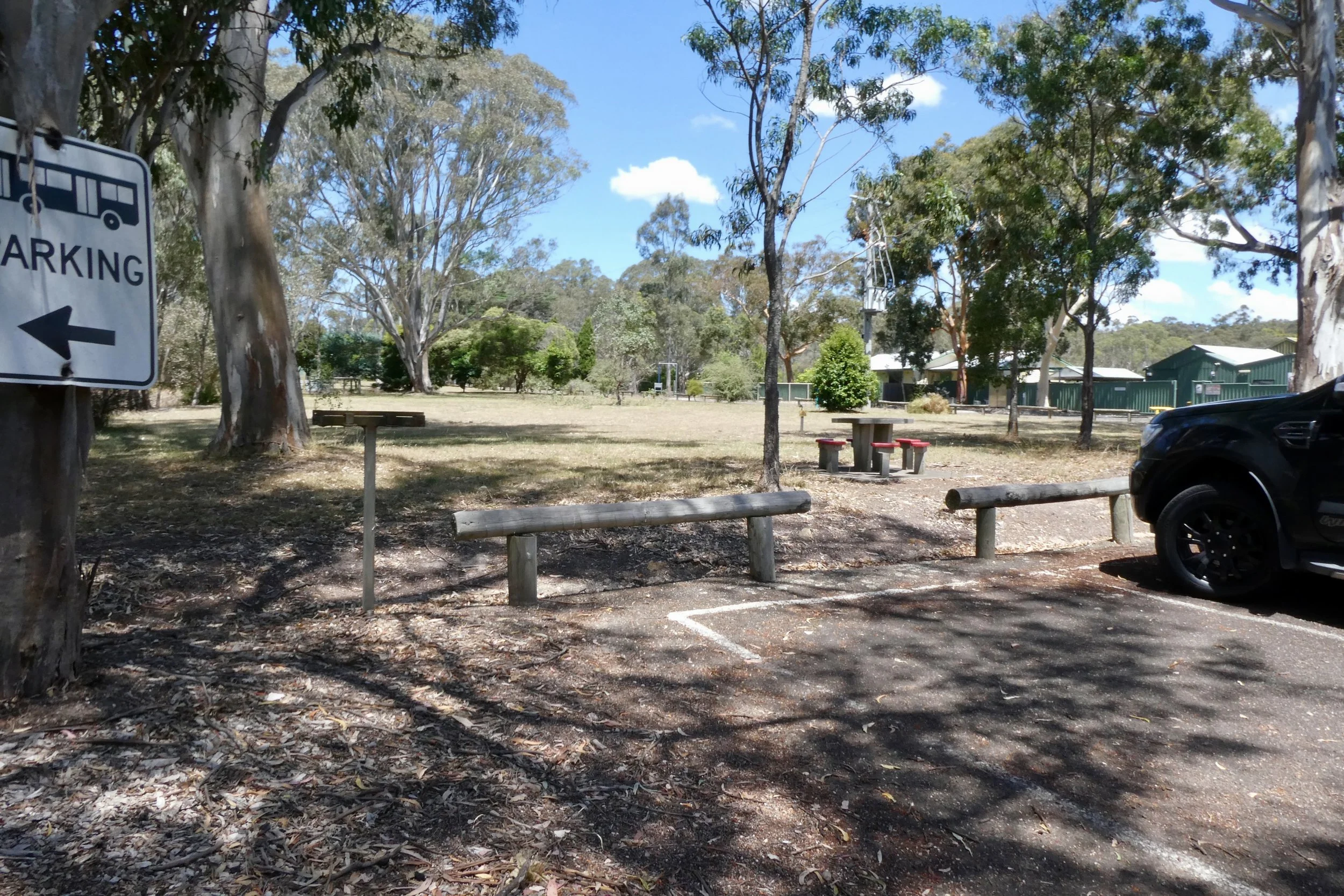
Ammenities wise, there's some picnic tables which are nice in a sort of artistic utilitarian sort of way, I'm pretty sure I've seen the same design of picnic table at road-side rest stops around the country.
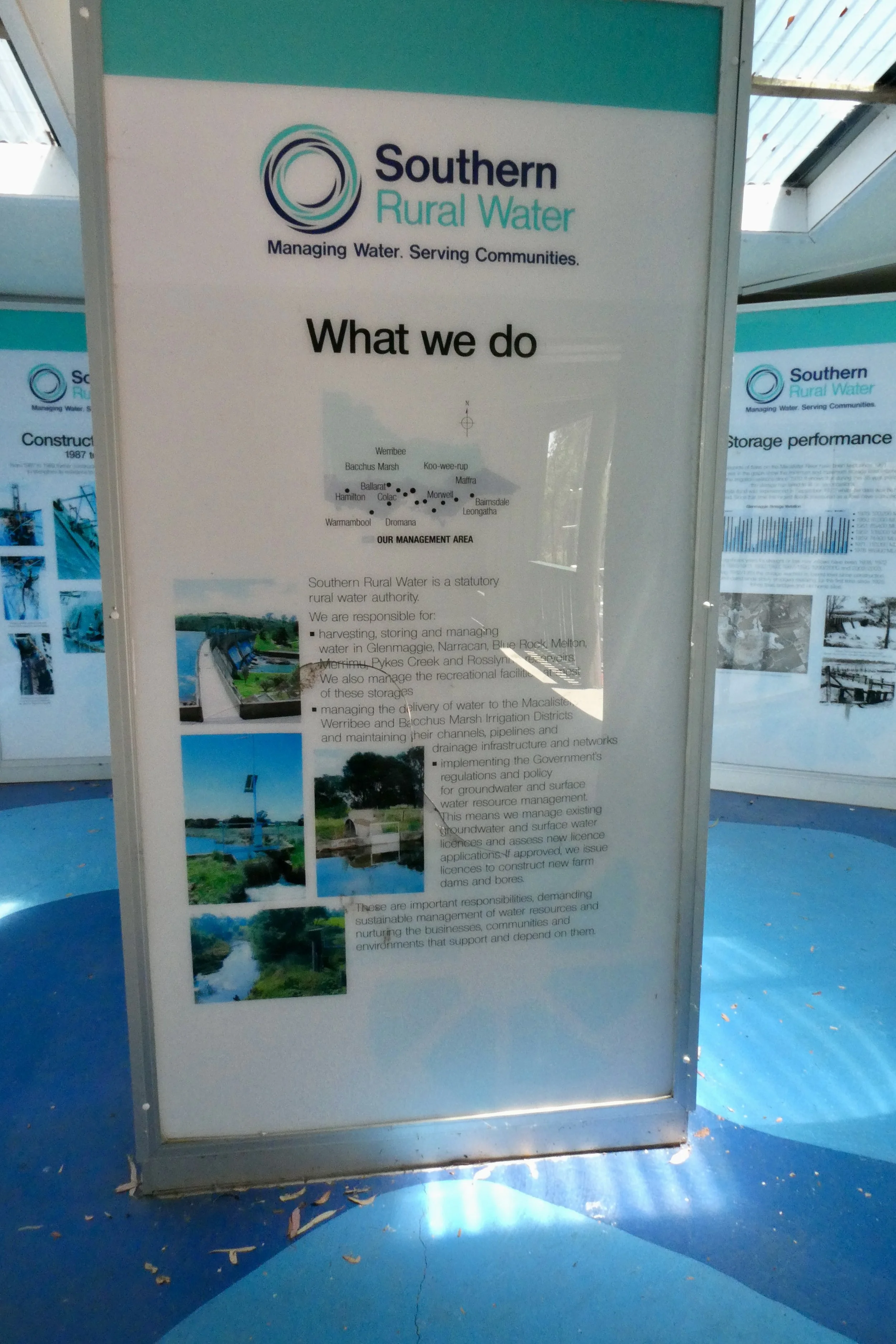
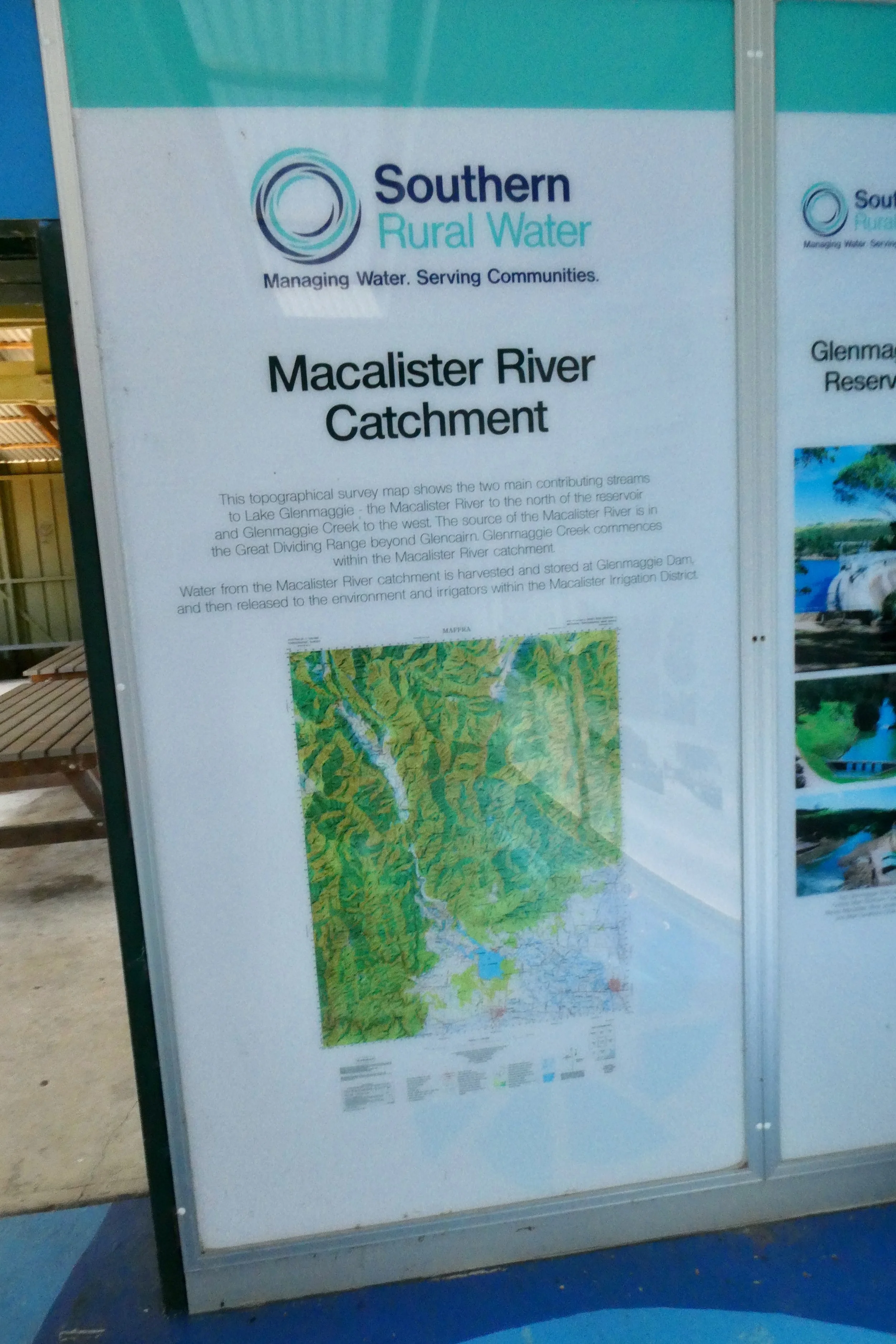
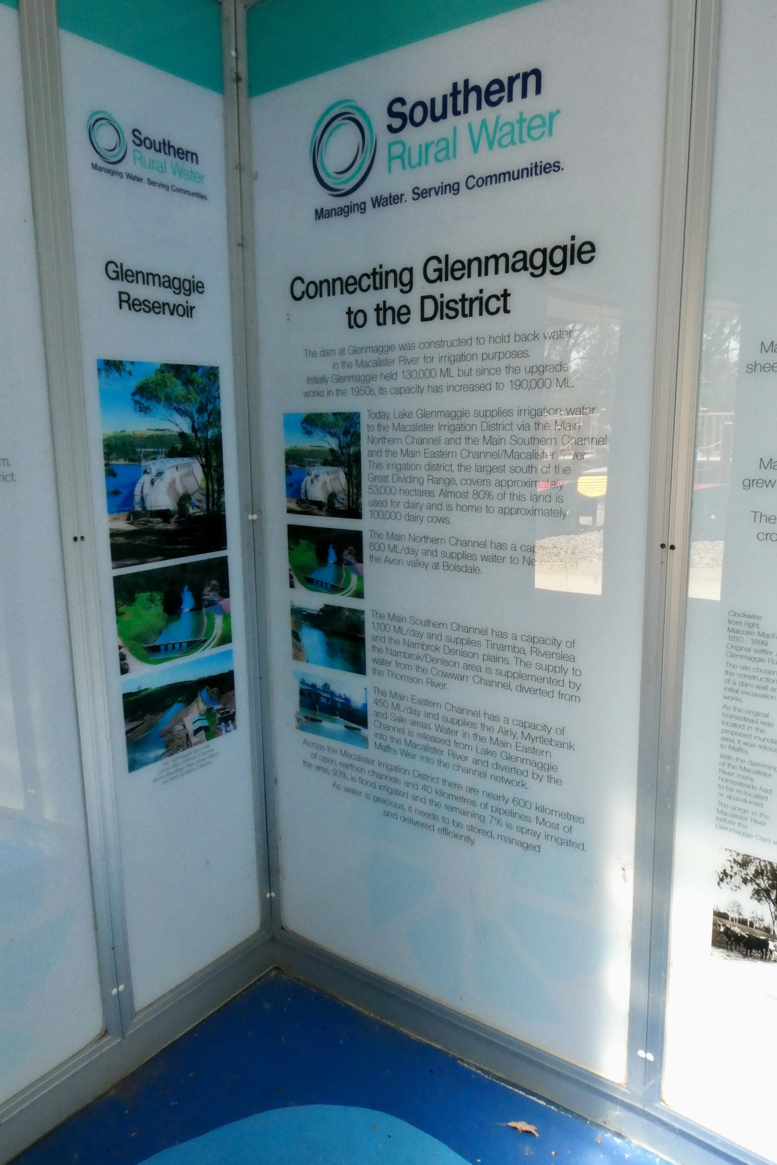
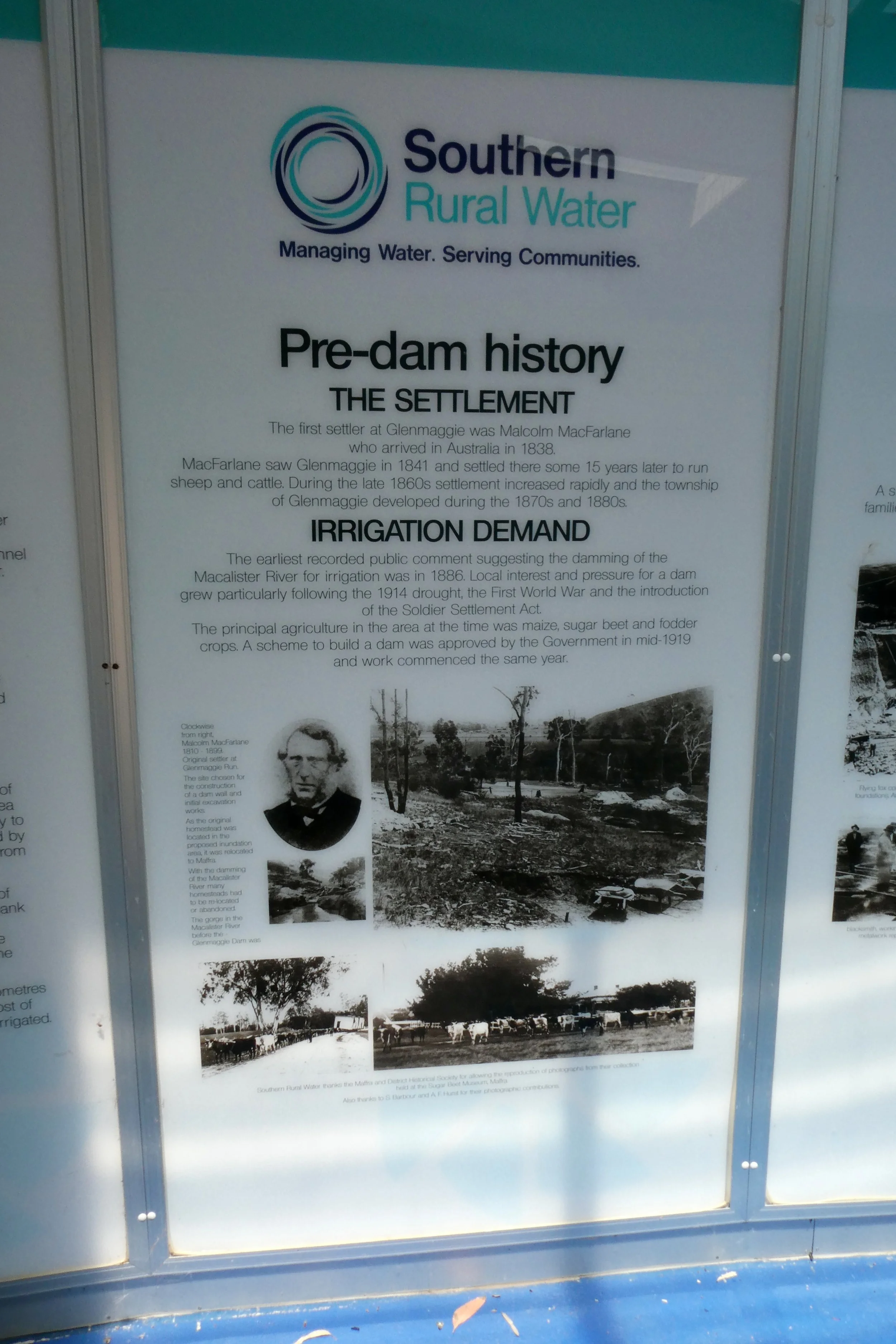
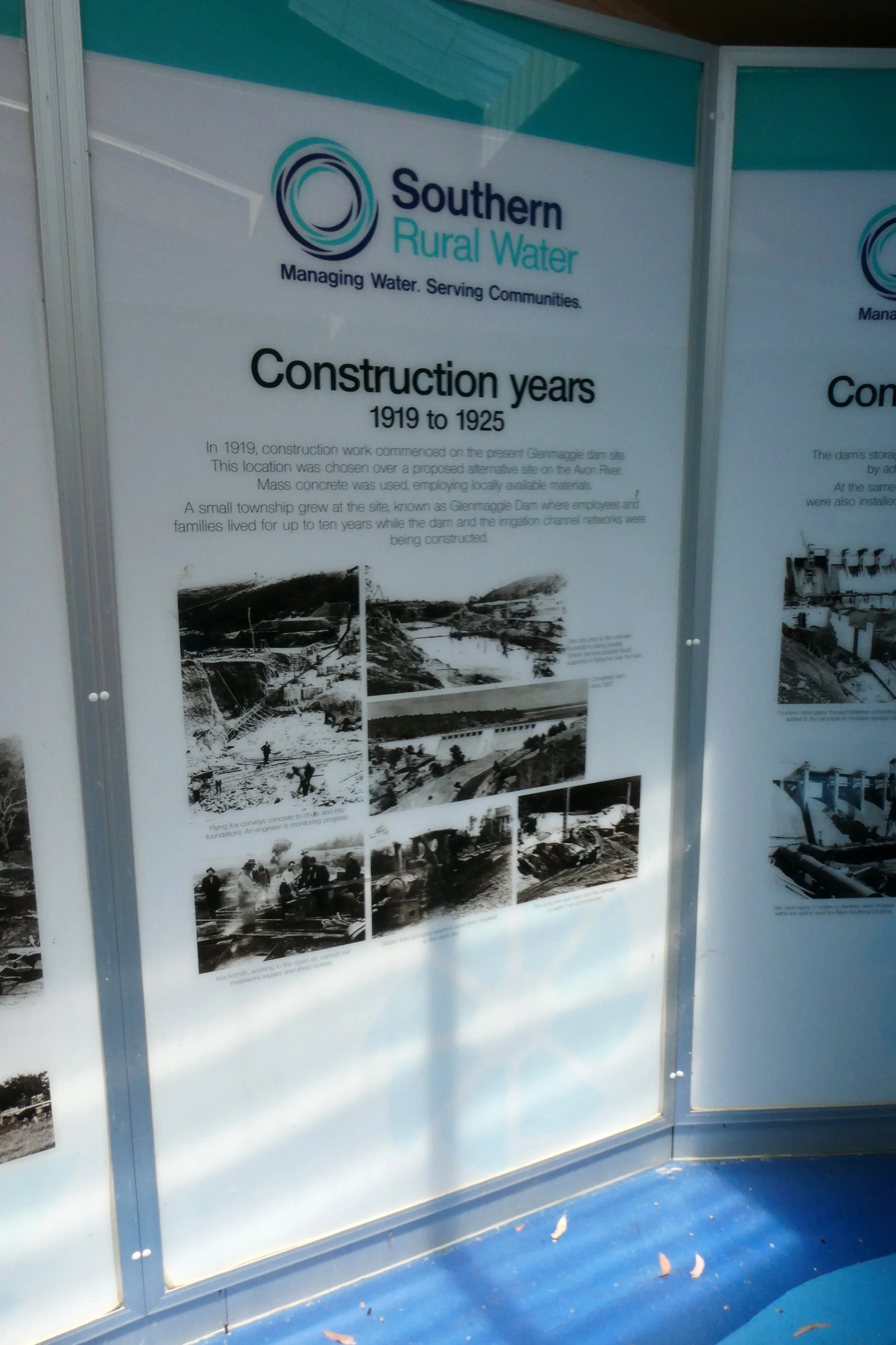
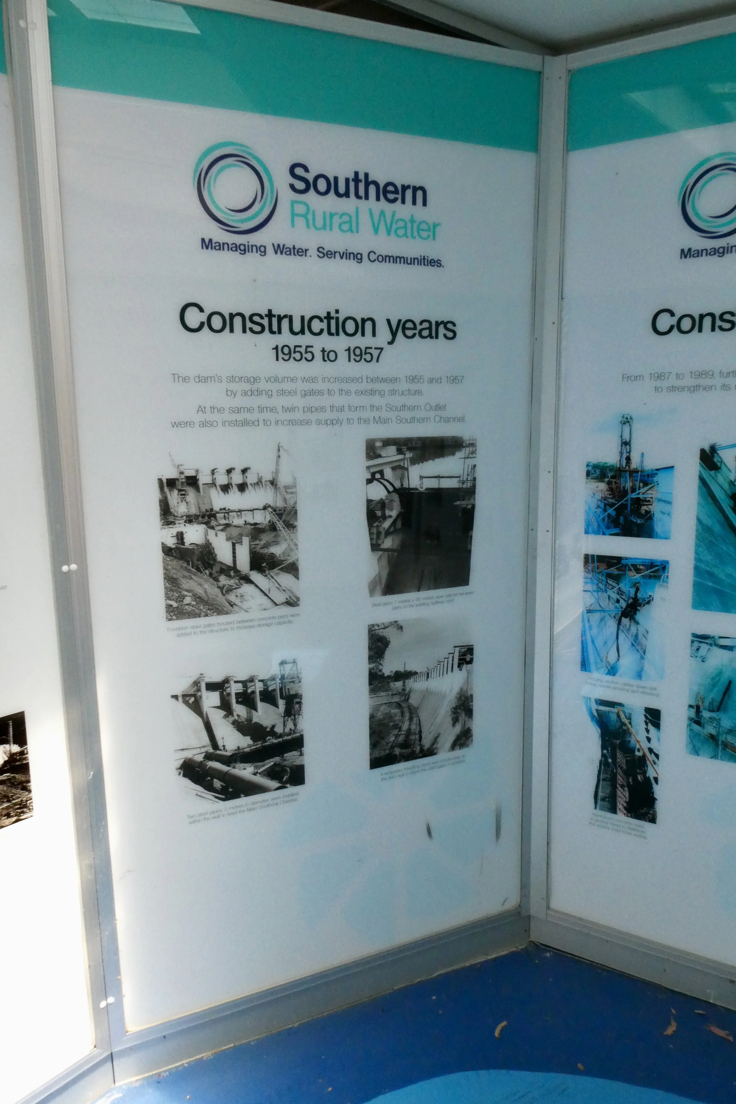
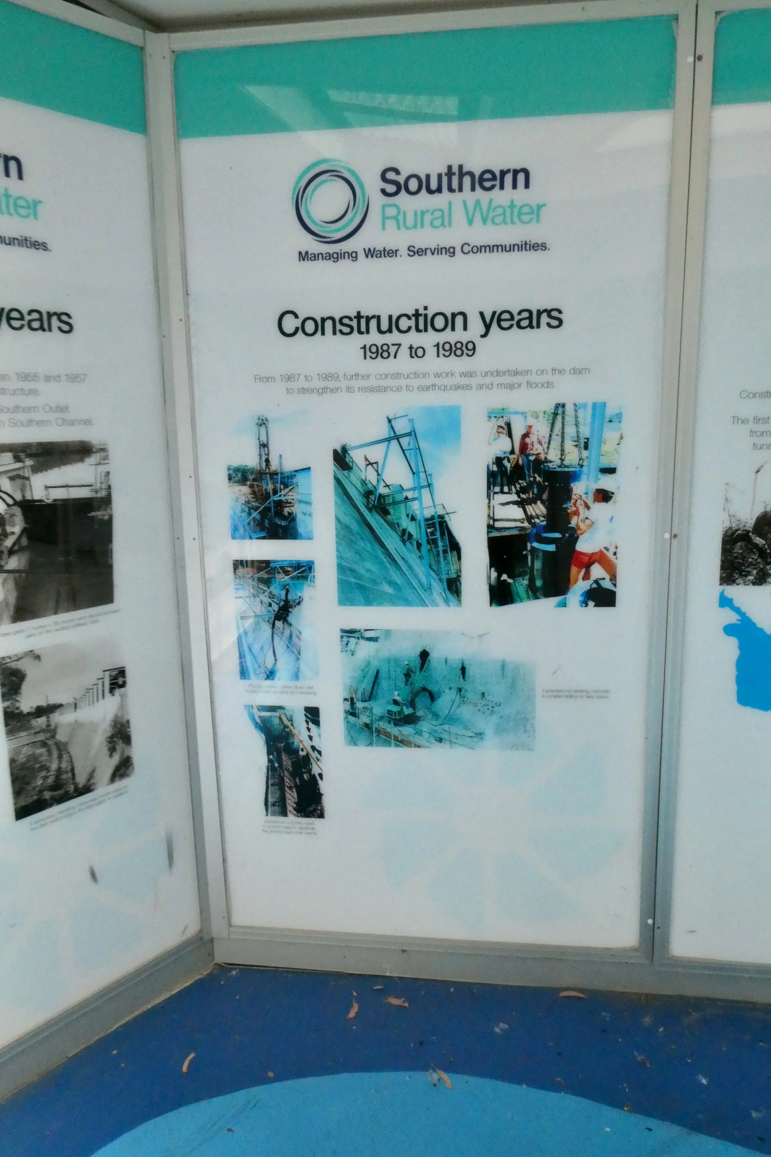
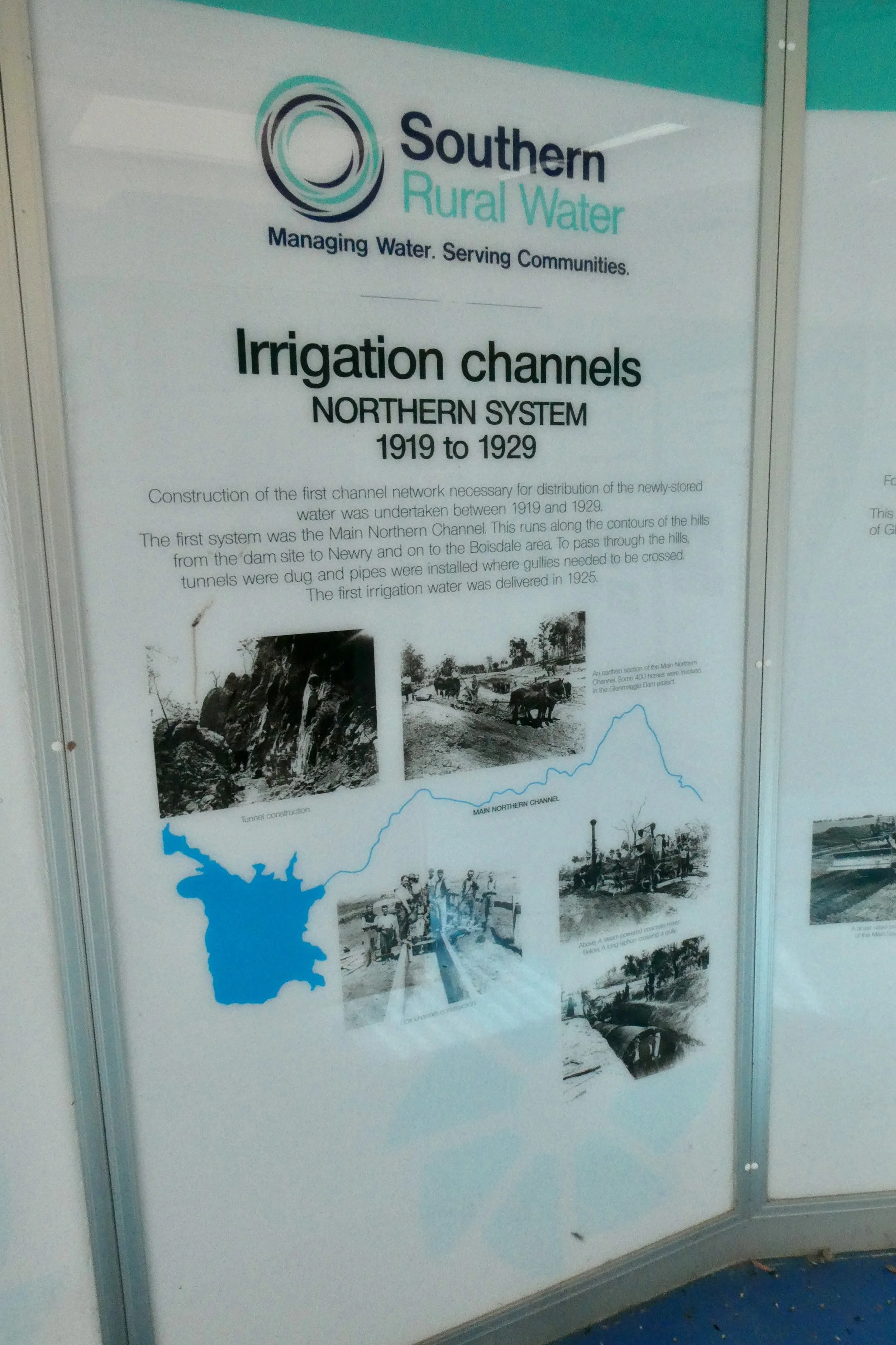
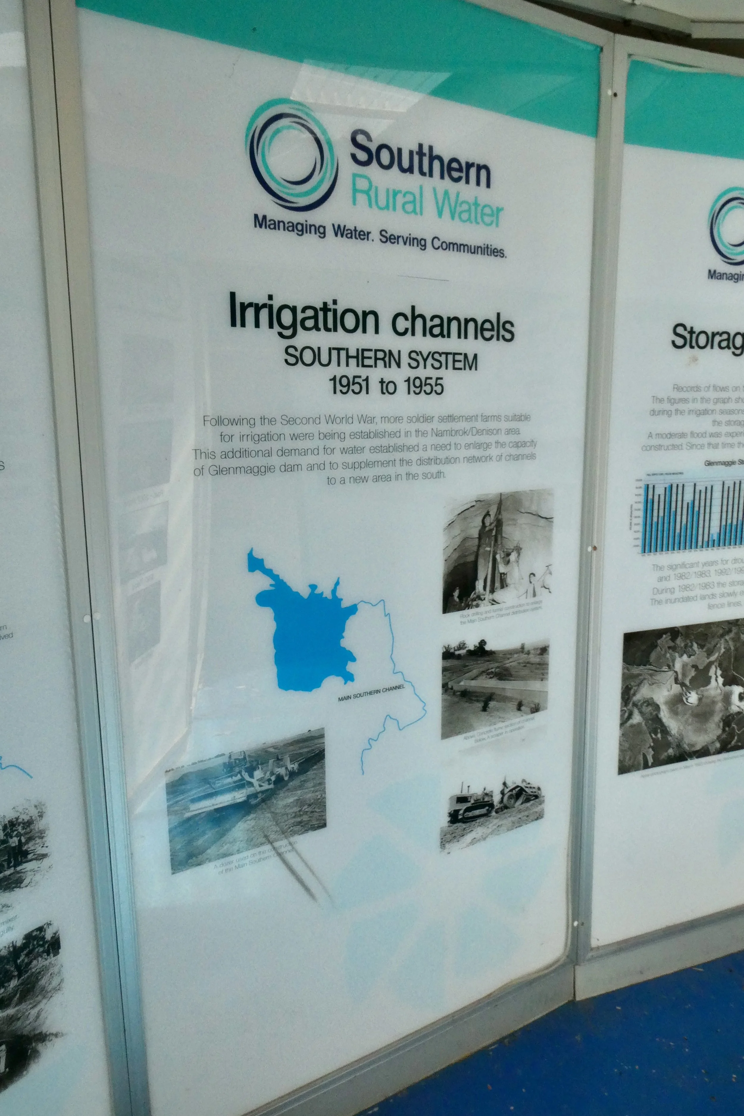
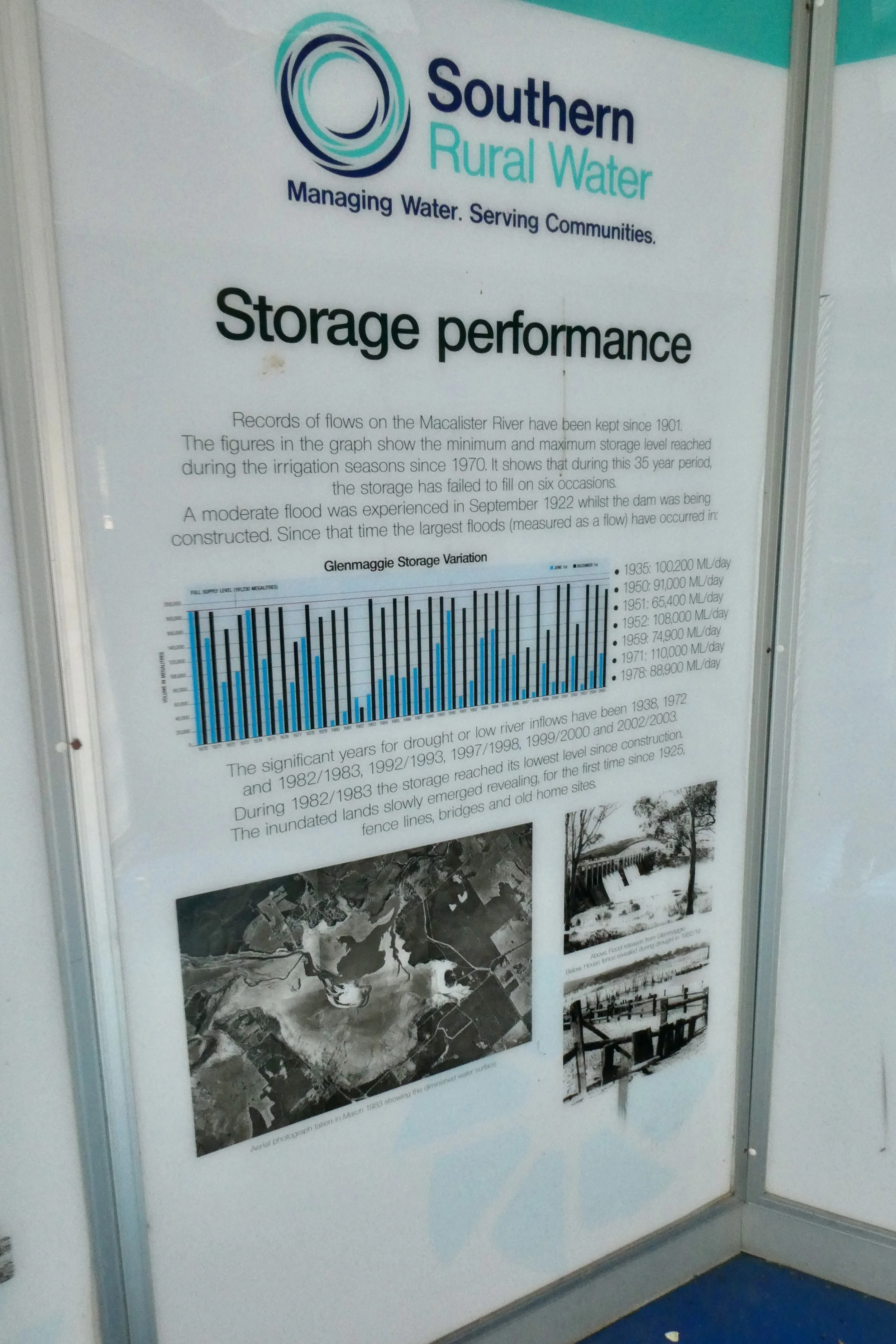
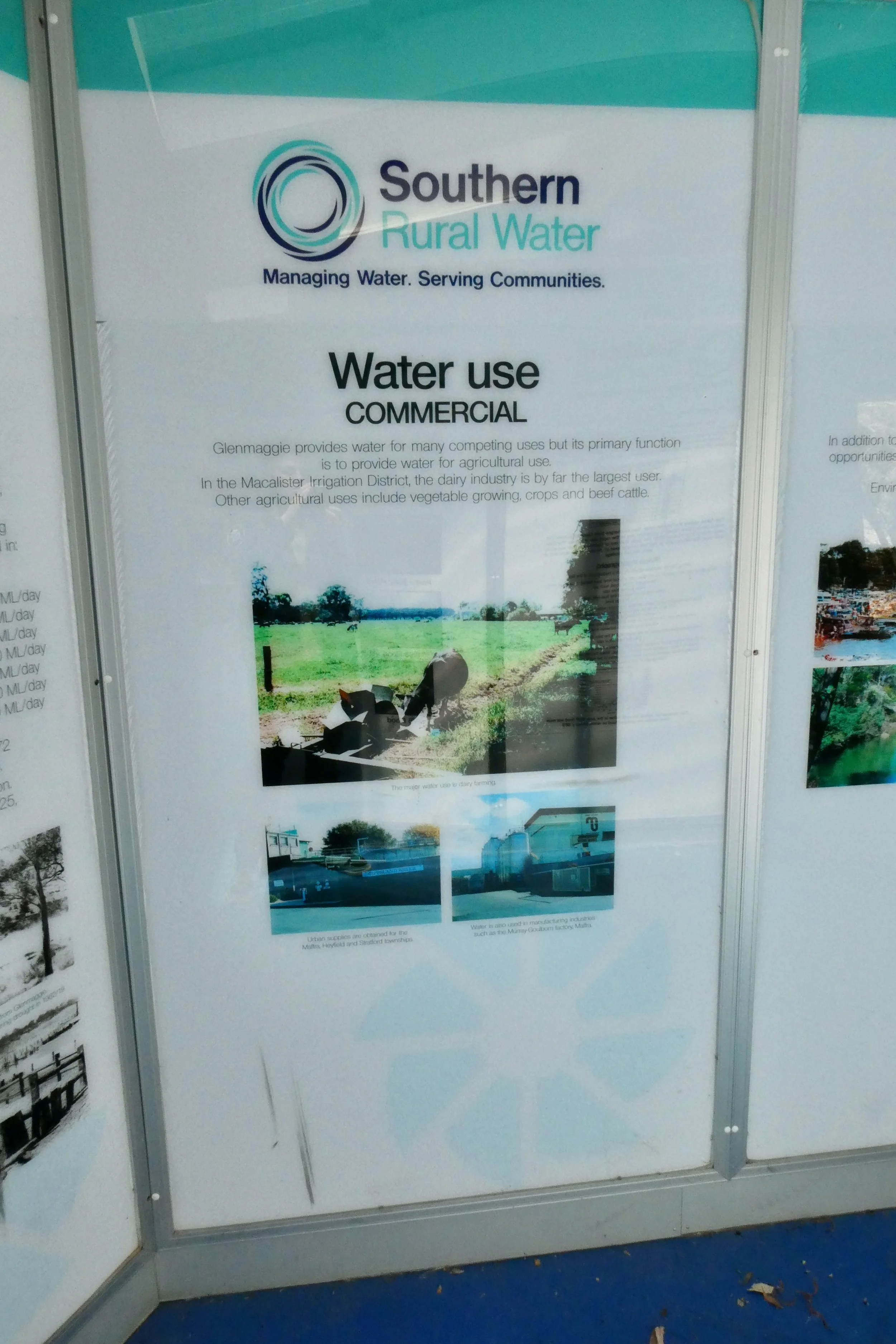
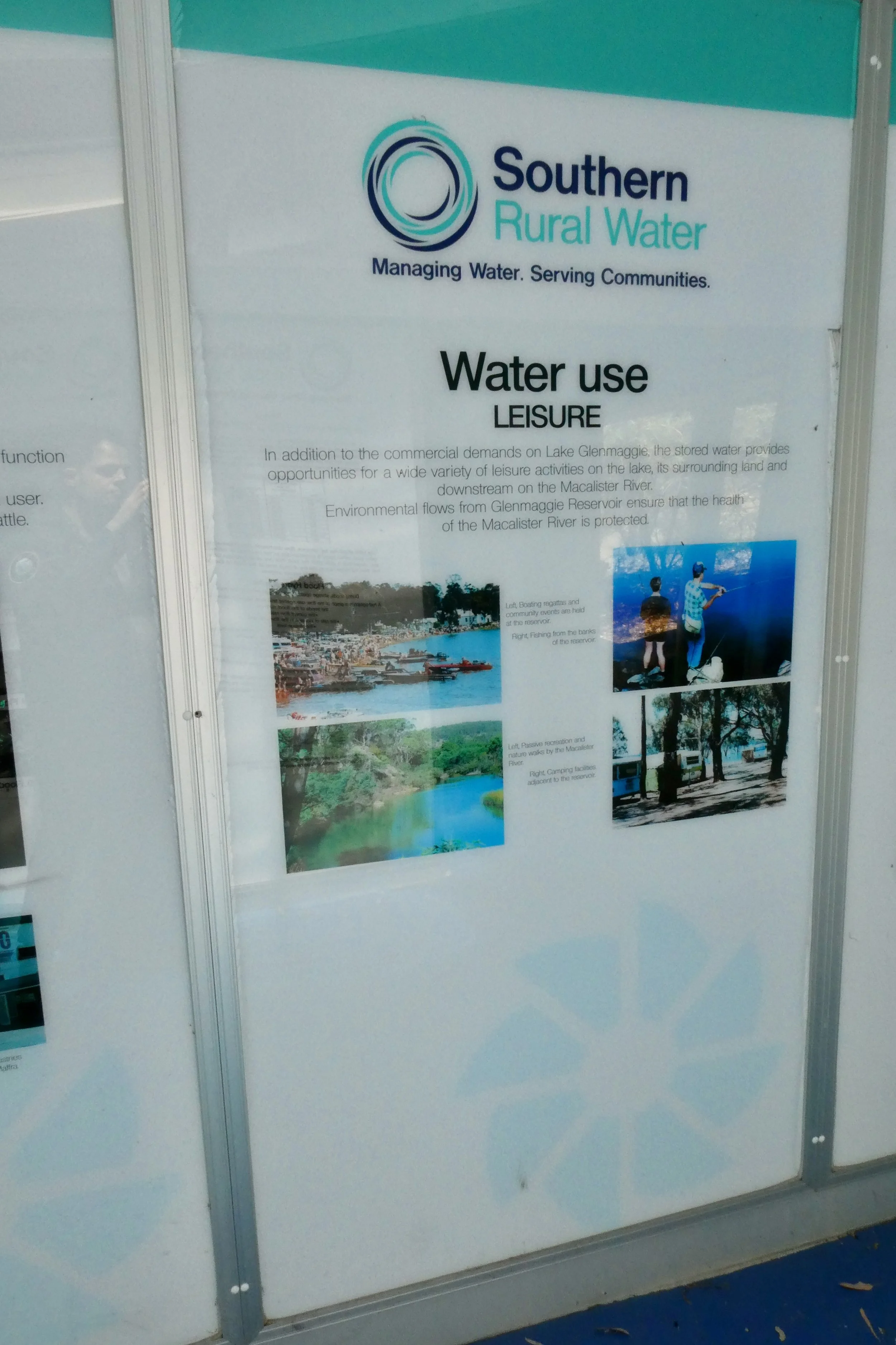
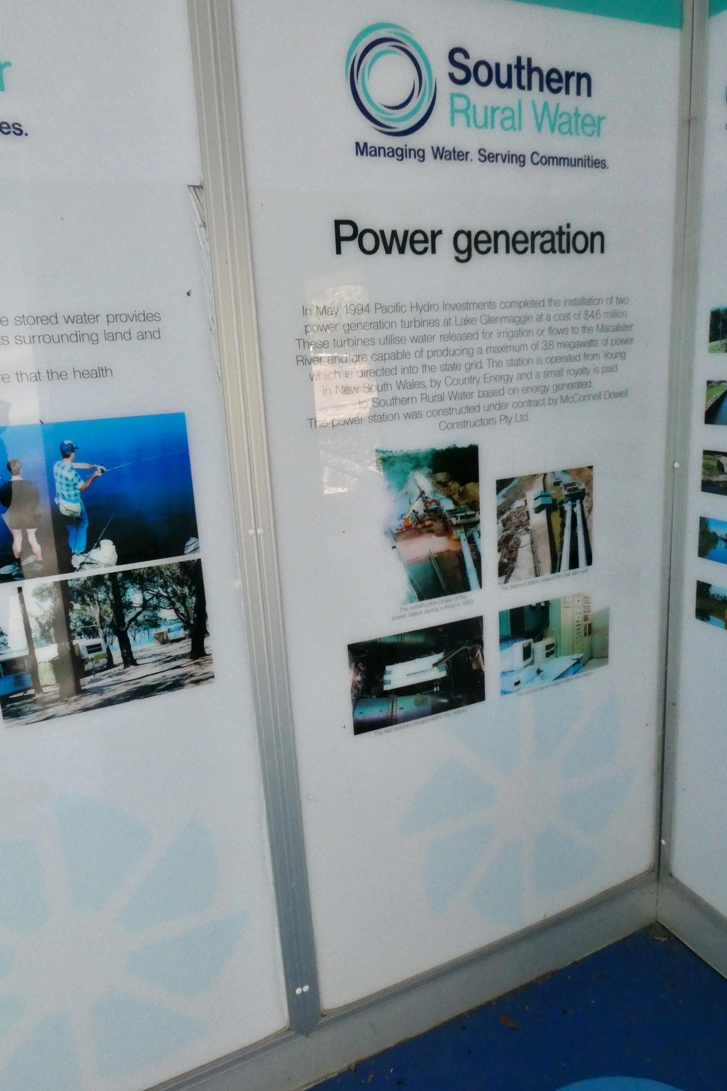
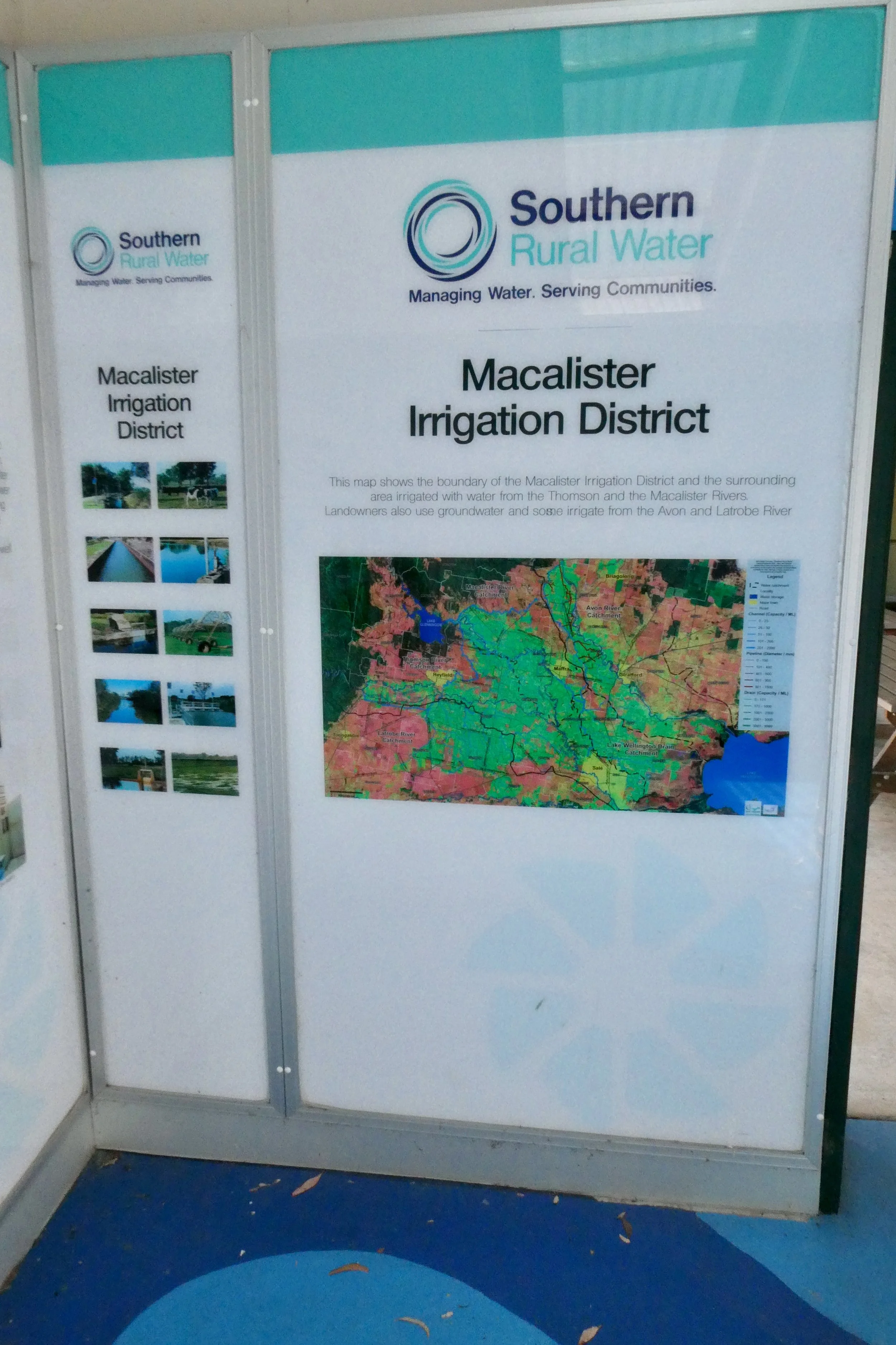
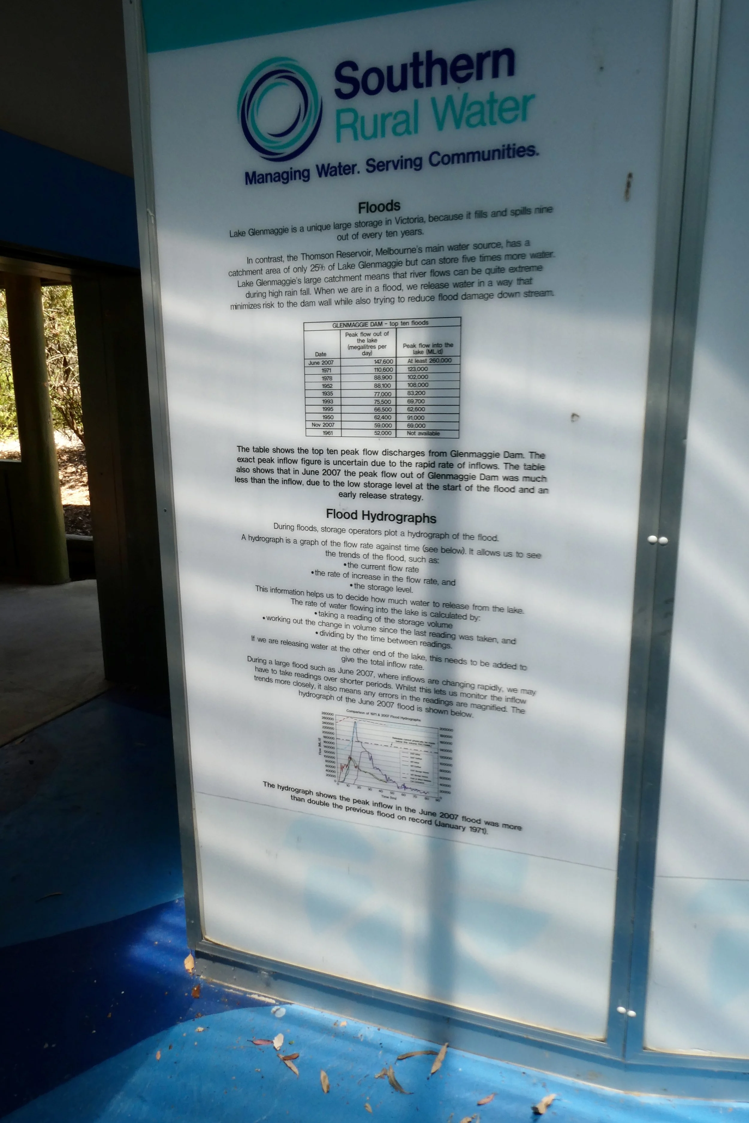
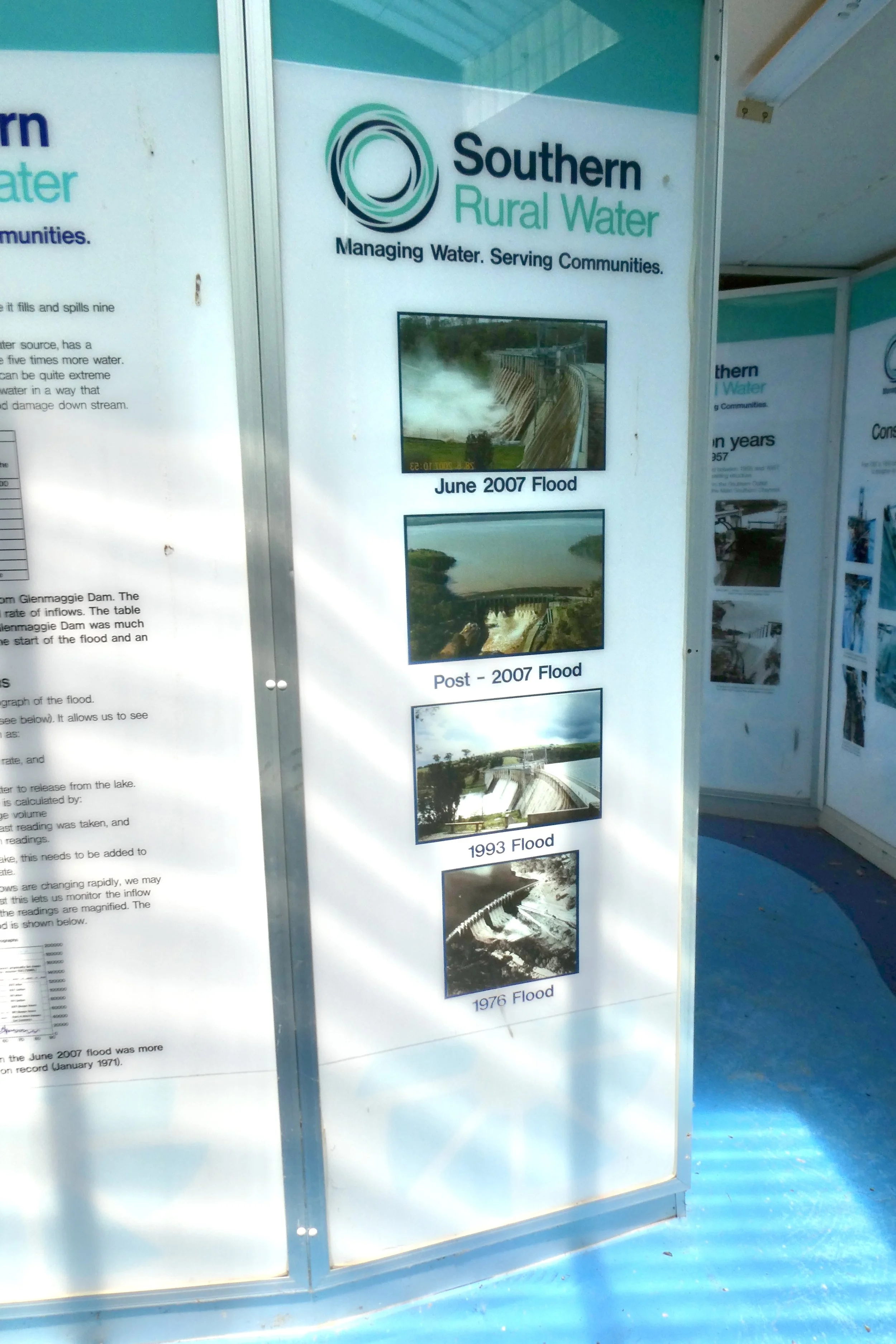
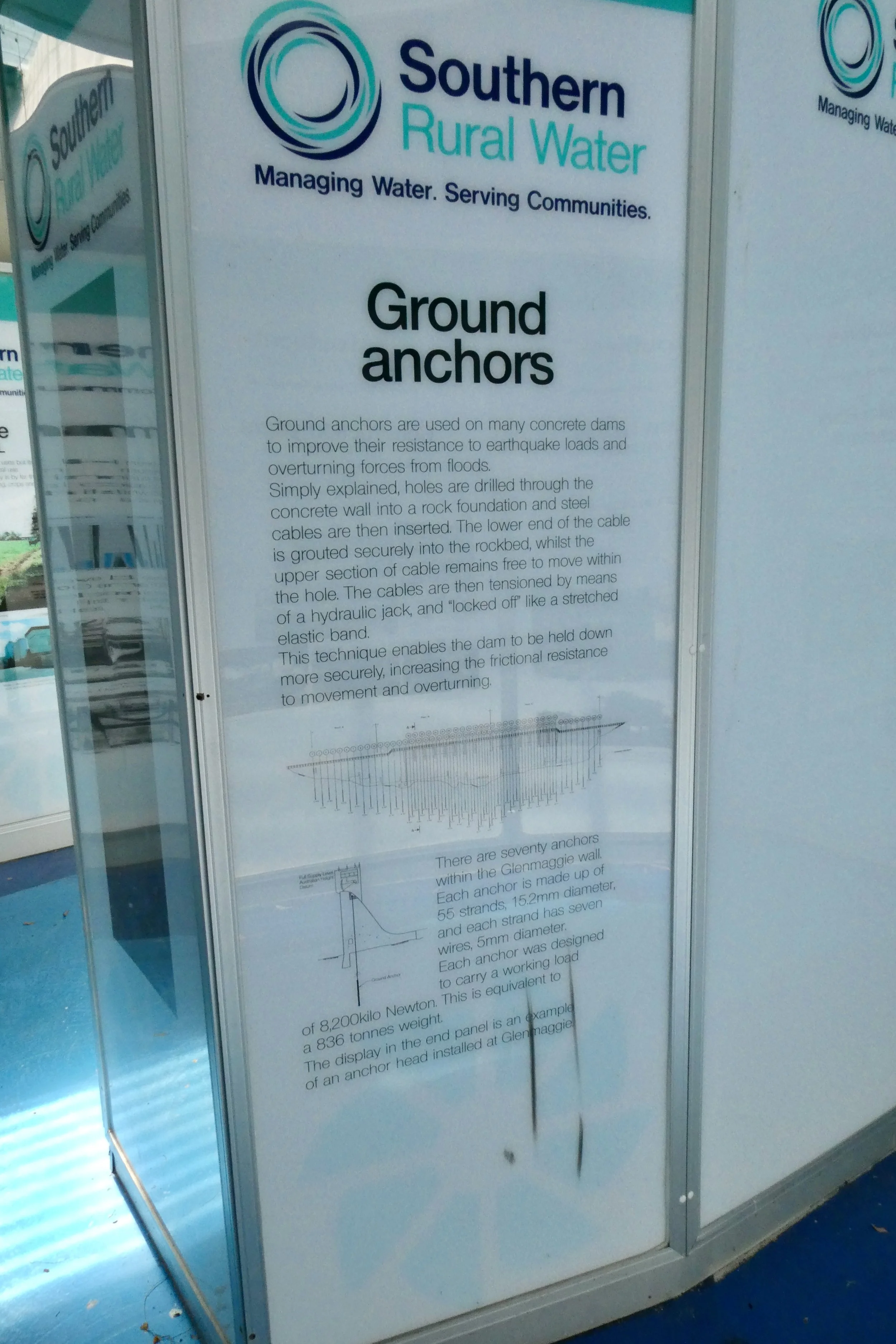
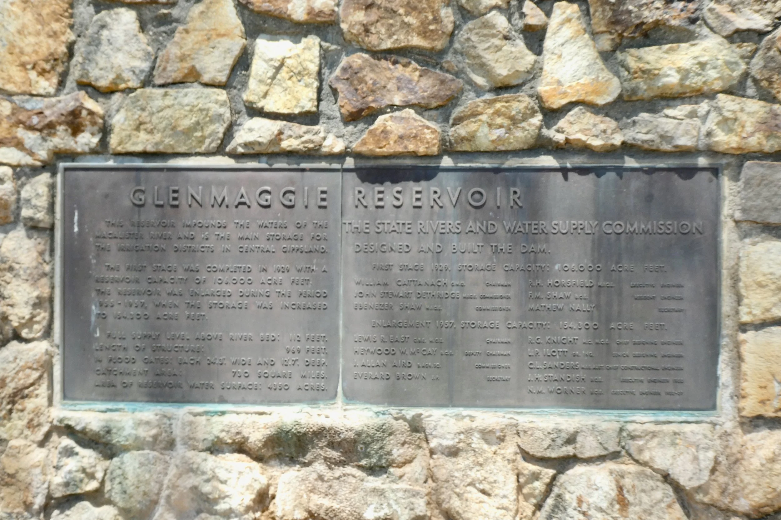
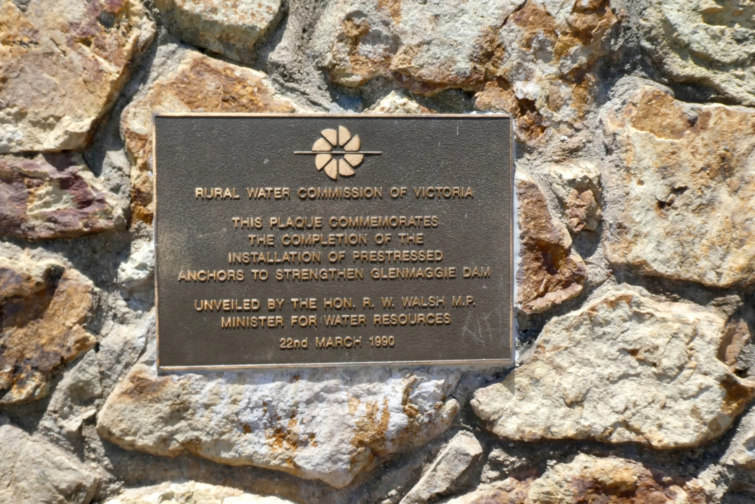
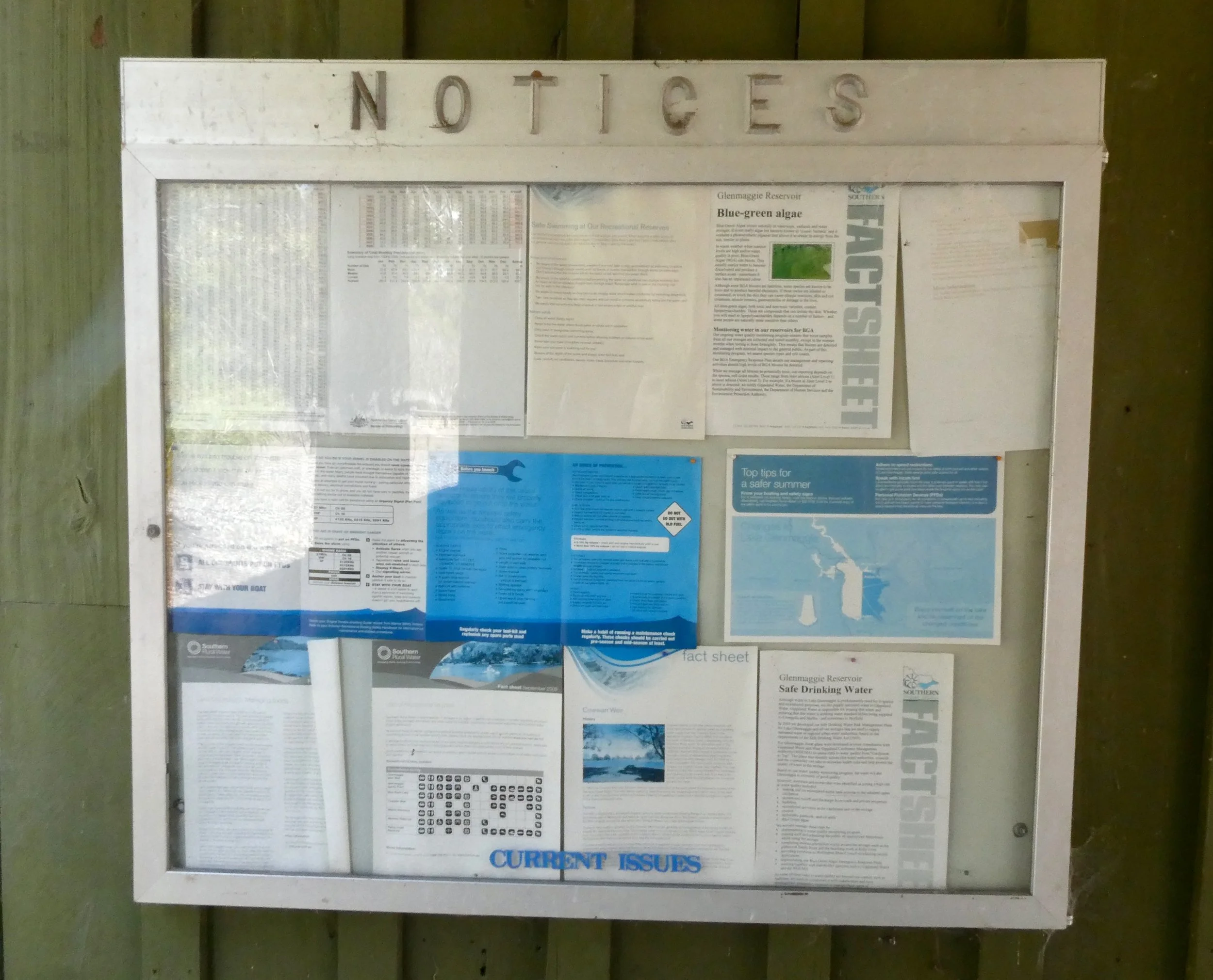
There's the aforementioned information hut the "Southern Rural Water Pictorial Display", there's also more picnic tables under cover in there.
There's a toilet block as well, which I availed myself of before departing.
The men's toilet has a single urinal and there's a single stall toilet as well with one sink.
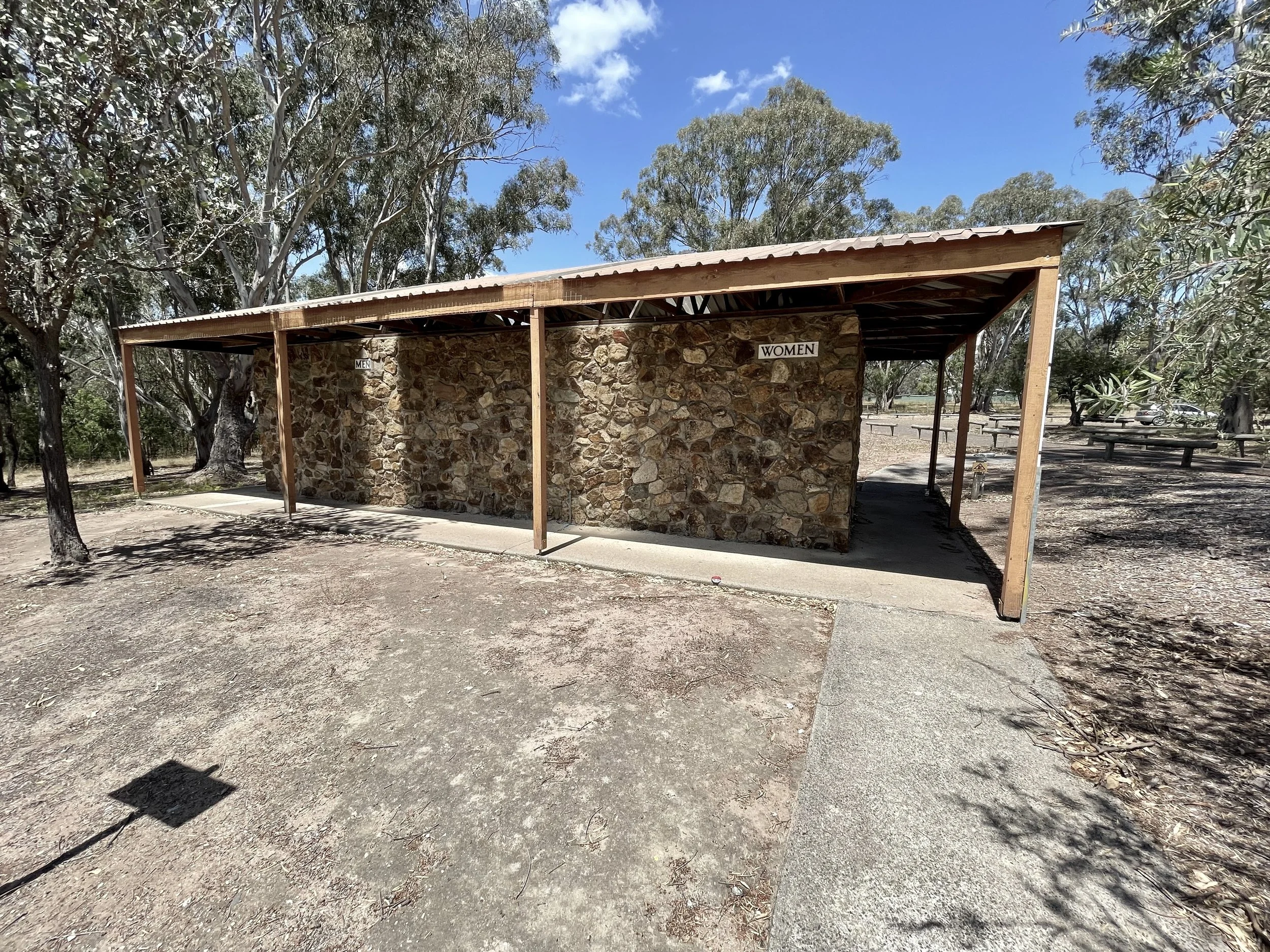

Interestingly on one side (the back I realised as I approached it) it says "Men" and "Ladies" and then on the front where you go in it says "Ladies" and "Gents". There's also a disabled toilet.
Leaving the road says 'warning road spikes' and to keep left, which it appeared to have the road spikes engaged, so I elected just to exit the way I came in and kept right. I just recently got new tyres and had no desire to shred them.
Leaving Lake Glenmaggie there was a very impatient person in a Fort Territory behind me, despite me doing to the speed limit of either or 100 he came up tailgating me, and then overtook me, accelerating away. I figured local who knows the roads, and paid it no mind. Looking at the map the township of Coongulla is past the weir and Weir Road is one of two that link to the township and Weir Road is the most direct into Heyfield, so imagine for those who live there it's an often travelled road, one that visitors get in the way of transversing.
The journey home was pretty uneventful, just a reverse of the journey out. There was a little more traffic on the road, a few more tractors and the like to overtake than on my way in.