It would have been a nice set of driver's roads, had I not been stuck behind a Hyundai SUV, who seemed to slam on the brakes every time they approached something that might vaguely be considered a corner.
There's something odd, in an interesting way about Neerim South and the area around it, it's all got a very designed feel in a weird sort of way. It made me think of a British town, not a fancy old one, just a newer one, I couldn't quite put my finger on what made it feel like that. Perhaps it was the well kept 1970s-style houses, tree lined streets, and a lot of European trees around leading up to Neerim South and other towns nearby.
To get to that point I had to go along the South Gippsland Highway, which feels like it gets worse each time I'm driving on it, and therefore there's not really much to say about that part of the journey, it is what it is.
Although whenever I'm on the South Gippsland Highway I'm always tempted by the donut van at the Koo Wee Rup observation tower. Have yet to actually stop, as it often feels like it's at the start of my journey and my adventure is the journey to the destination as much as the destination, and I shouldn't be stopping anywhere on the way there as that's a sort of delay to the goal of the day.
But I also think that if I'm going to have a doughnut it needs to be great as a treat sort of thing, and a lot of them are just okay. Growing up there was a doughnut van at Frankston trash and treasure market, and I'd always remember how yellow the dough was, how oddly shaped they were and how molten the jam was within, and crispy on the outside. A lot of doughnut vans their doughnuts are so perfectly shaped, industrially produced uniformity.
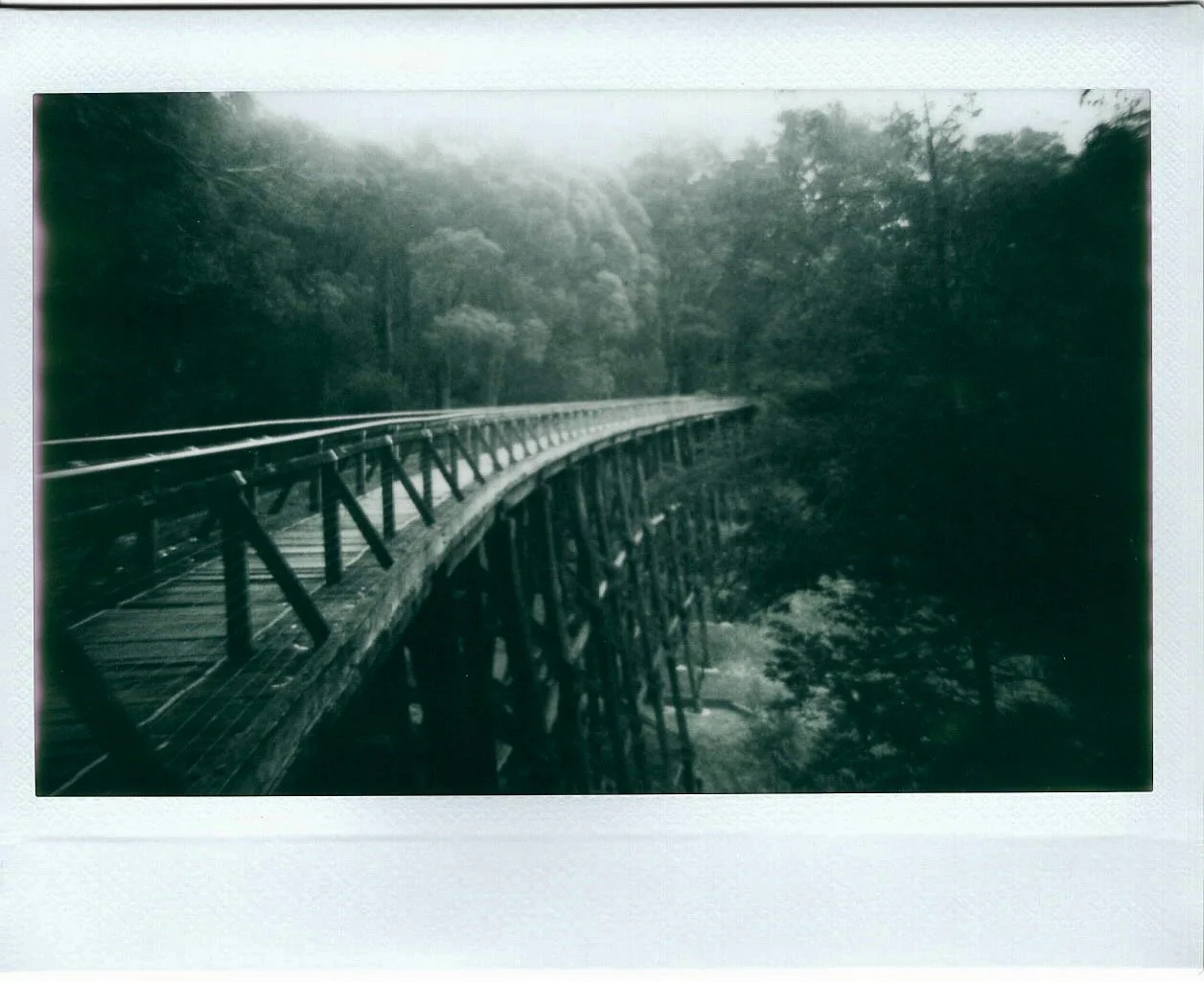
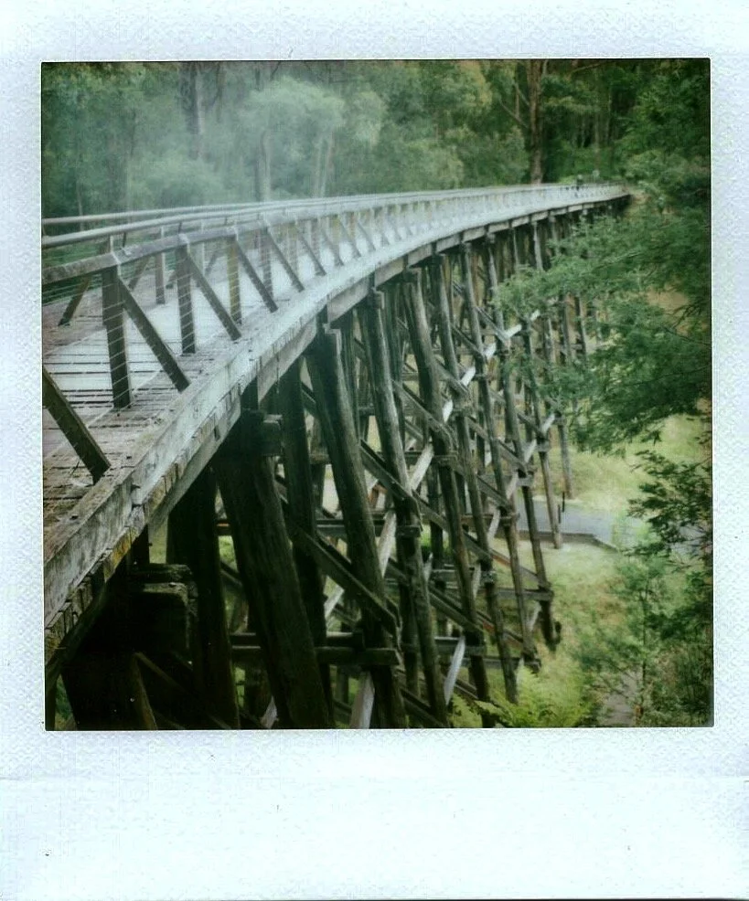
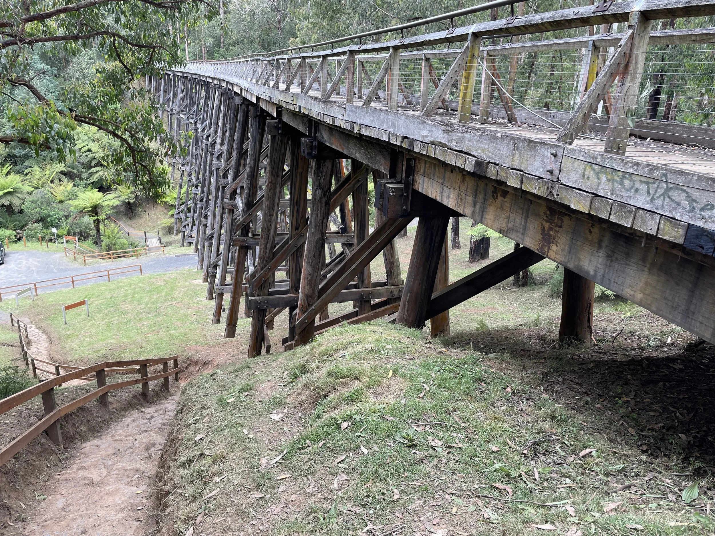
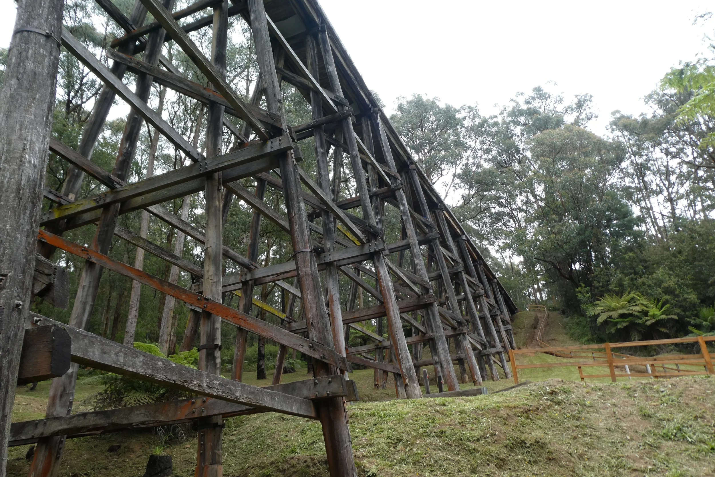
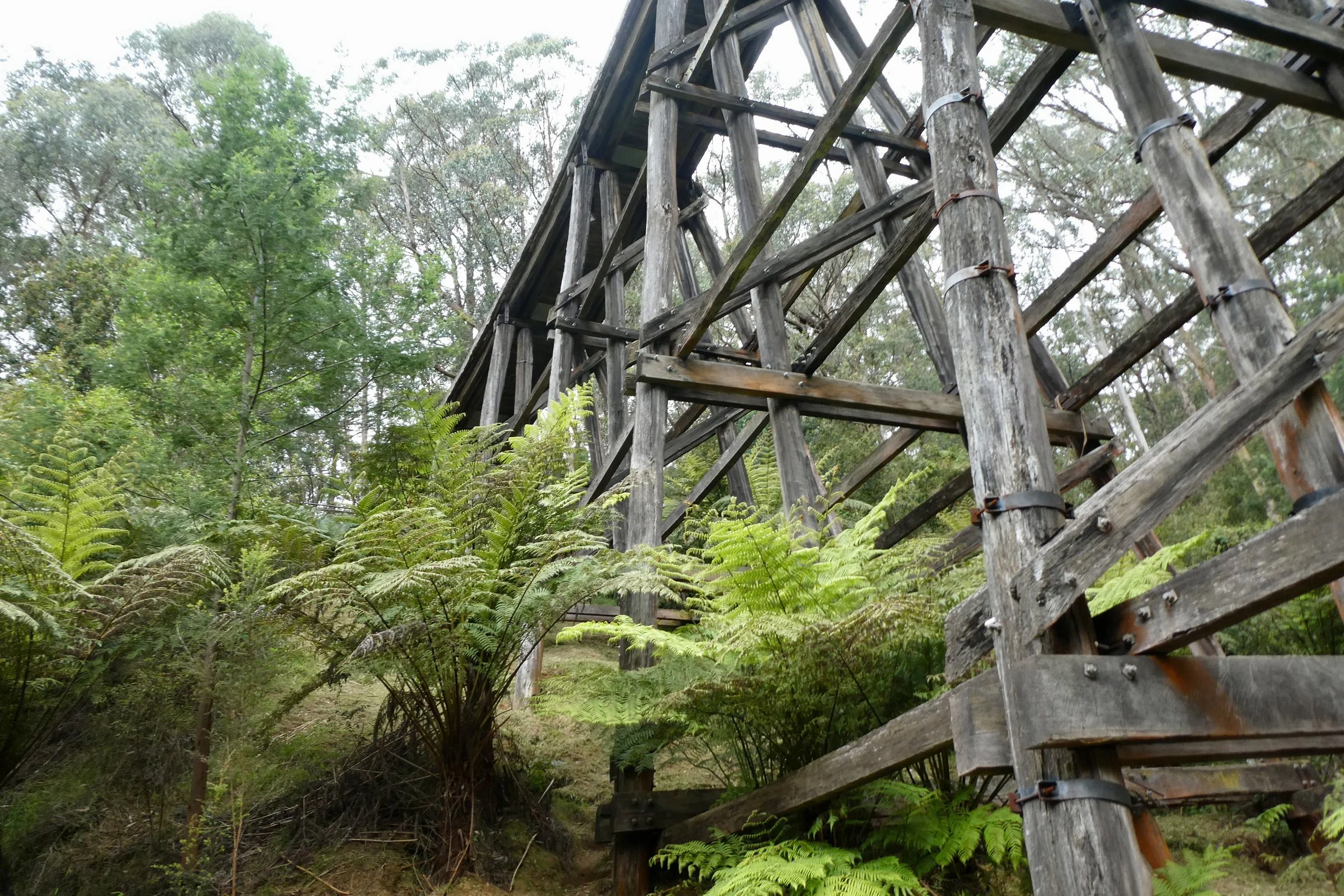
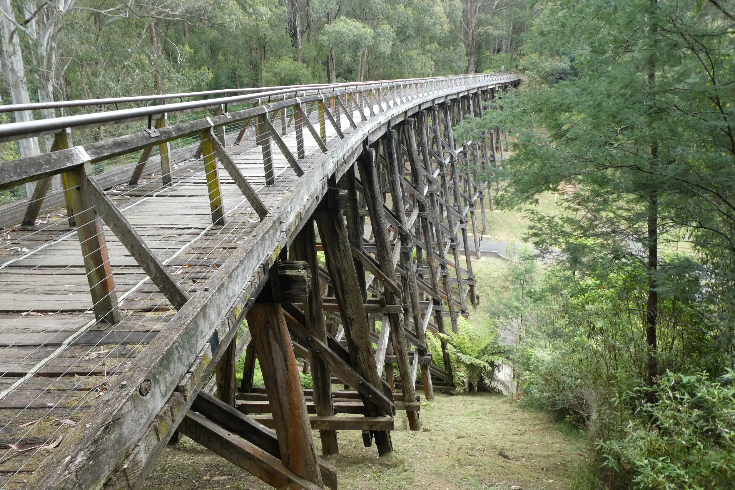
Anyway, the rail trestle bridge.
The car park.
Driving into the trestle bridge car park the road weaves around a few trees, there's parking for probably 10-12 cars, although the day I went there were only 4 cars parked quite spread out.
There are three paths to the top of the bridge, standing looking at the bridge there's the left path, that crosses a creek and then goes up a set of stone stairs that are set into the hill, this is undercover of the trees and ferns around
Then there's the right path which is much more open, and also goes up stone stairs.
And a third which weaves its way around the landscape up to the top.
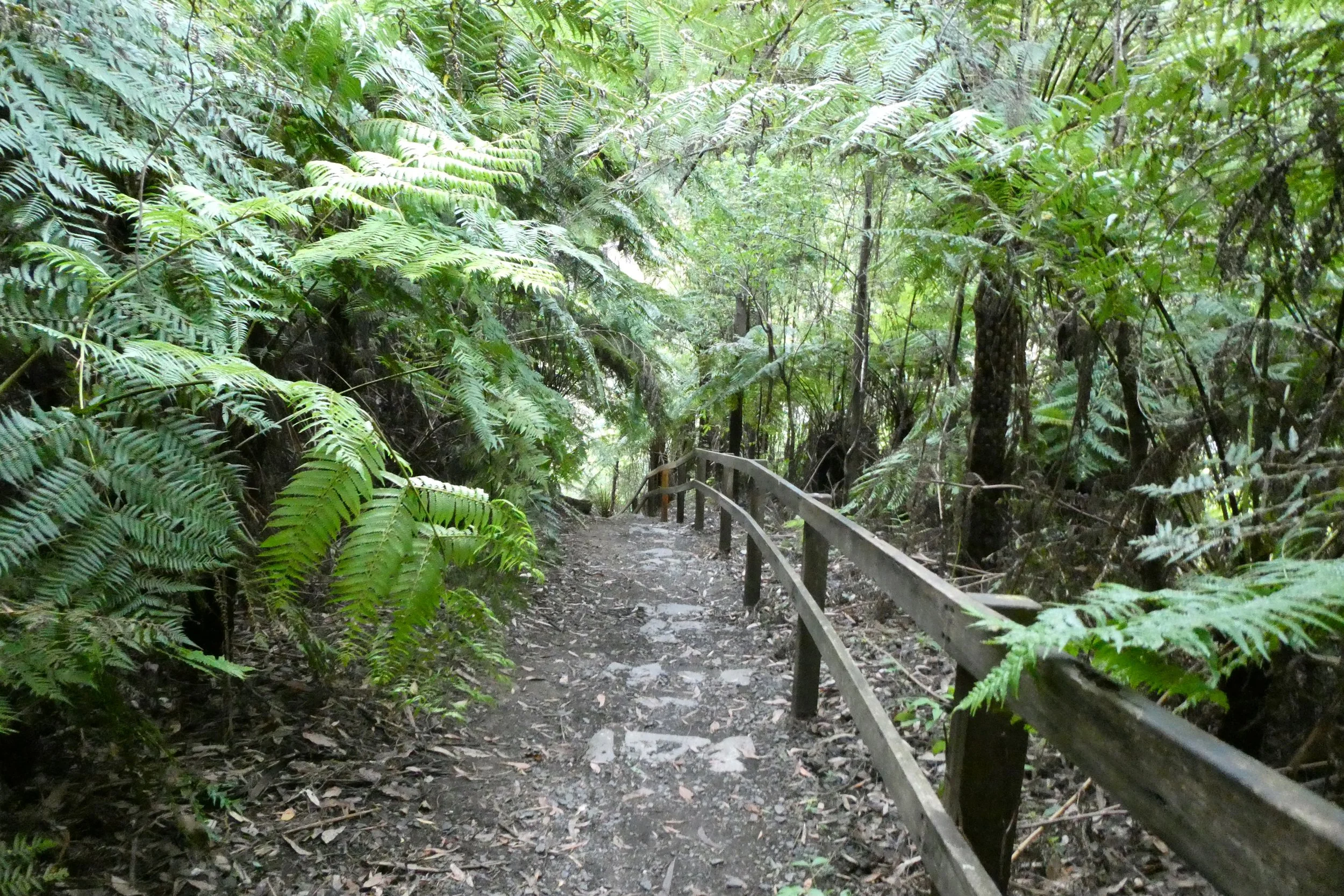
I took the left path because there were some people taking the other right path.
I think I chose right, both paths have steep stairs, but going down the more open set of stairs is better than the darker path of ferns and trees.
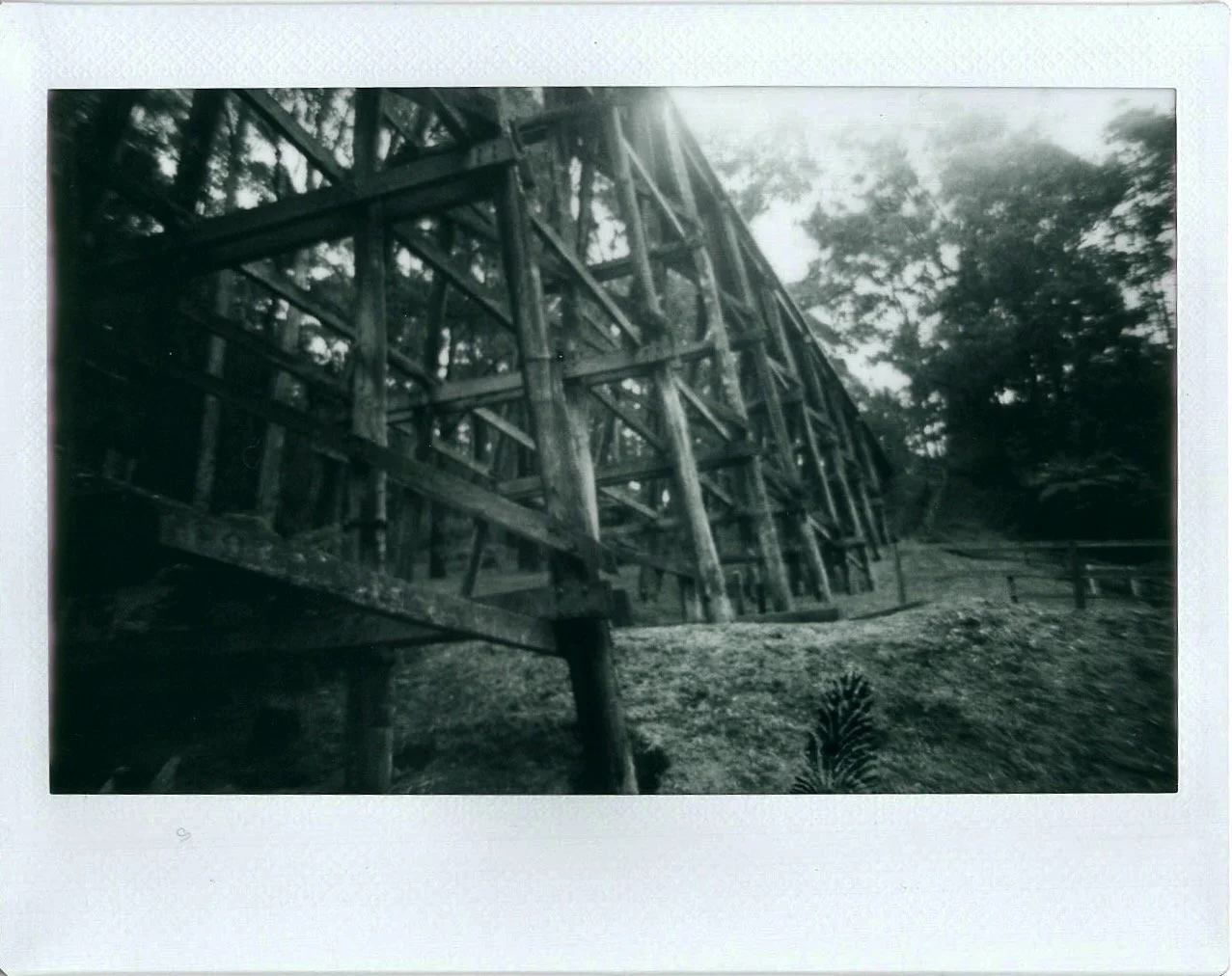
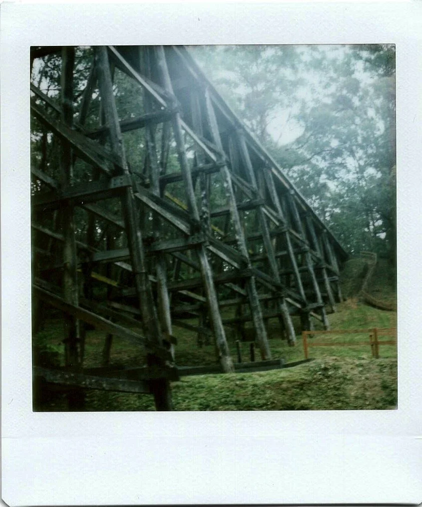
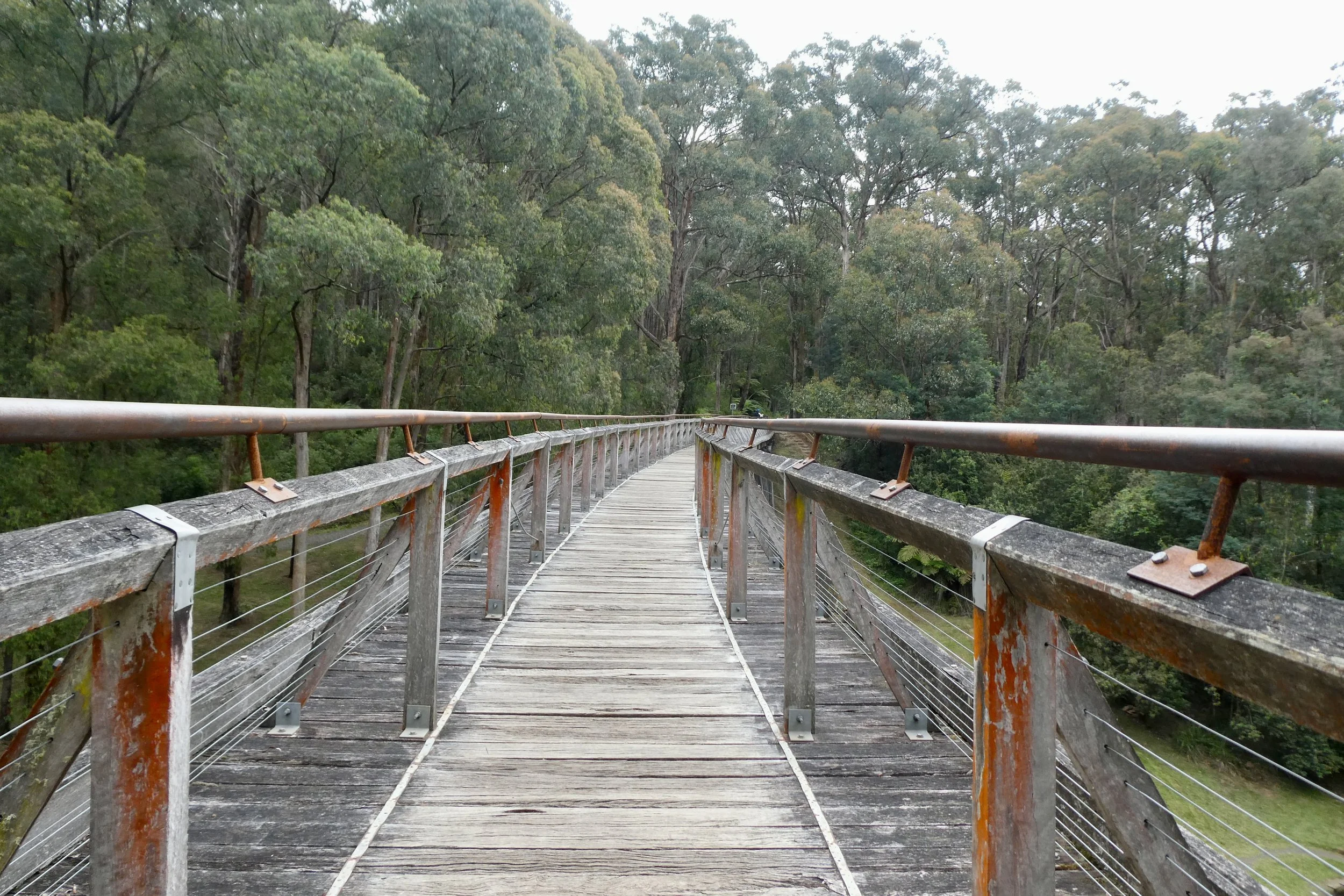
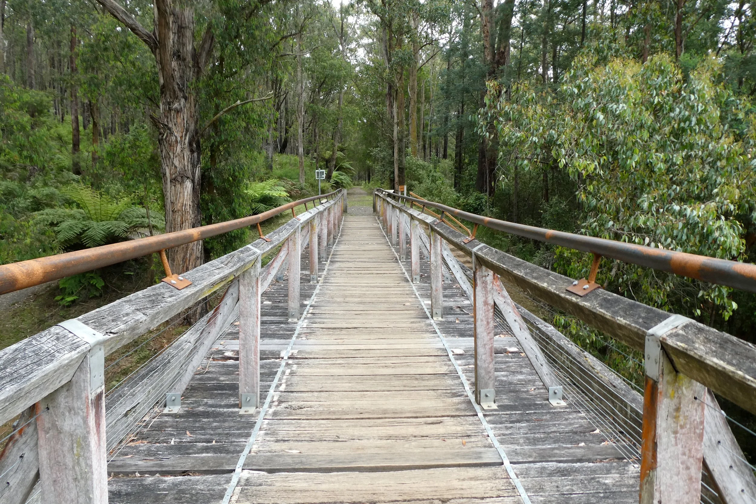
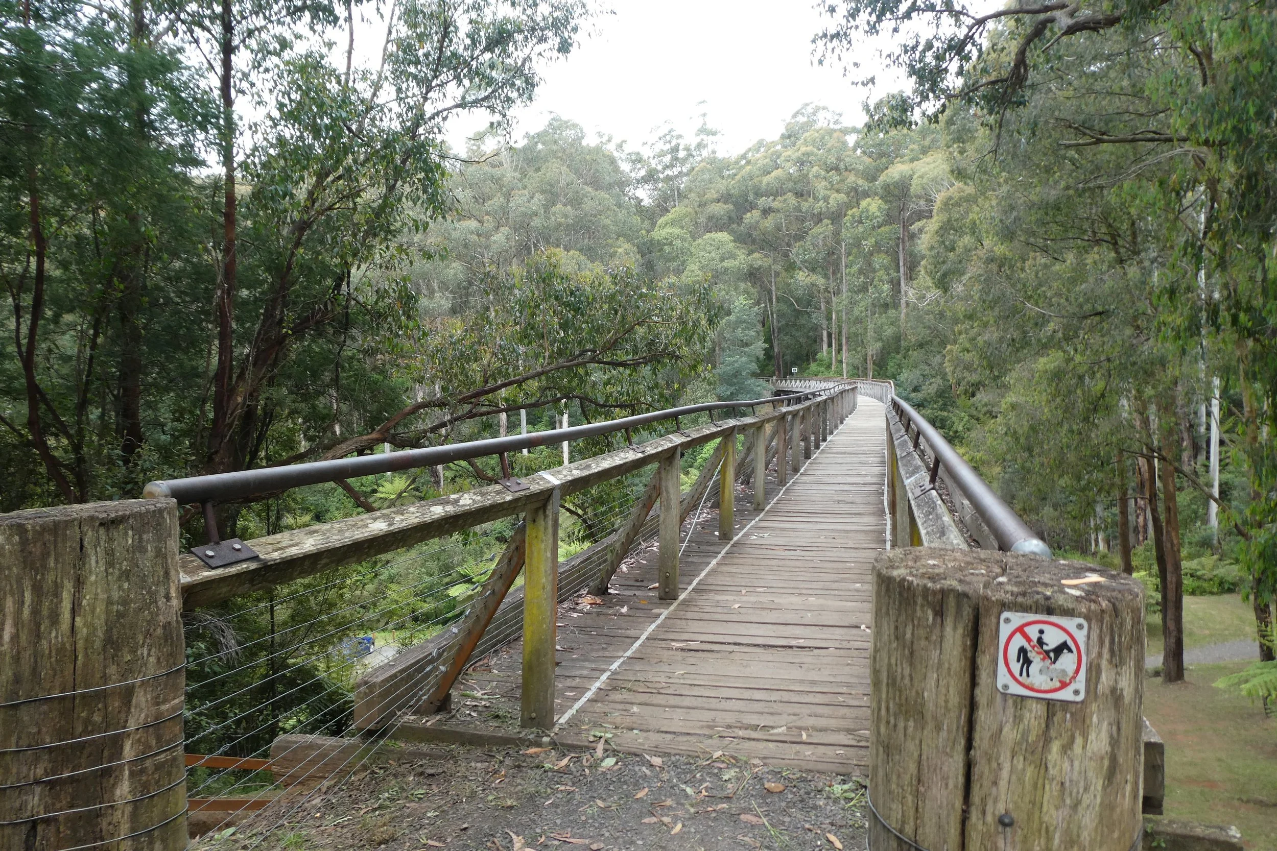
The bridge itself is impressive in its size and construction. There is a disconcerting 'Bridge Capacity Maximum 10 Persons' sign, and walking along it, you certainly feel the age of the bridge. Or at least below my feet, wearing skate shoes the wooden panels certainly felt old and well worn and a little loose in sections. I could certainly appreciate you wouldn't want more than 10 people on the bridge's surface larking about.
There are two picnic tables at the bottom opposite the car park, one accessed via some steps and also a path that would let you access the two.